


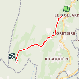
St Egreve - Le belvedere du scialet

bob2023
User


51m
Difficulty : Easy

FREE GPS app for hiking
 SityTrail
IGN / Geographical institutes
SityTrail Plus
The world is yours!
About
Trail Walking of 1.8 km to be discovered at Auvergne-Rhône-Alpes, Isère, Proveysieux. This trail is proposed by bob2023.
Description
Petite randonnée du dimanche, à faire le matin pour éviter la chaleur (ça monte). Très beaux points de vue sur Grenoble et st-Egrève. Attention à ne pas rater le petit sentier (petit cairn) en fin de balade.
Il est plus facile de se garer dans le village.
Positioning
Comments