


verdeusciolu

barney06
User
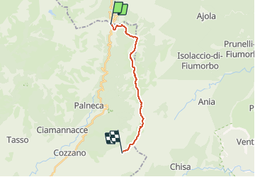

Length
15.2 km

Max alt
1997 m

Uphill gradient
1268 m
Km-Effort
31 km

Min alt
1296 m

Downhill gradient
816 m
Boucle
No
Creation date :
2018-06-26 10:53:12.833
Updated on :
2018-06-26 10:53:12.833
3h00
Difficulty : Unknown

FREE GPS app for hiking
 SityTrail
IGN / Geographical institutes
SityTrail Plus
The world is yours!
About
Trail Other activity of 15.2 km to be discovered at Corsica, Haute-Corse, Ghisoni. This trail is proposed by barney06.
Positioning
Country:
France
Region :
Corsica
Department/Province :
Haute-Corse
Municipality :
Ghisoni
Location:
Unknown
Start:(Dec)
Start:(UTM)
516139 ; 4652920 (32T) N.
Comments