


kuromidake

betf
User
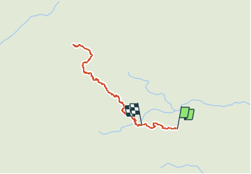

Length
9.5 km

Max alt
1813 m

Uphill gradient
579 m
Km-Effort
17.1 km

Min alt
1367 m

Downhill gradient
546 m
Boucle
No
Creation date :
2018-06-26 11:10:22.623
Updated on :
2018-06-26 11:10:22.623
5h51
Difficulty : Difficult

FREE GPS app for hiking
 SityTrail
IGN / Geographical institutes
SityTrail World
The world is yours!
About
Trail Walking of 9.5 km to be discovered at Kagoshima Prefecture, Kumage County. This trail is proposed by betf.
Positioning
Country:
Japan
Region :
Kagoshima Prefecture
Department/Province :
Kumage County
Municipality :
Kuromi-dake
Location:
Unknown
Start:(Dec)
Start:(UTM)
647510 ; 3352973 (52R) N.
Comments
Trails nearby