


22.04.2018 - Pont Rouault

babeth35
User

Length
1.2 km

Max alt
55 m

Uphill gradient
33 m
Km-Effort
1.7 km

Min alt
17 m

Downhill gradient
33 m
Boucle
Yes
Creation date :
2018-06-26 10:58:57.097
Updated on :
2020-07-20 15:06:45.487
20m
Difficulty : Very easy

FREE GPS app for hiking
 SityTrail
IGN / Geographical institutes
SityTrail Plus
The world is yours!
About
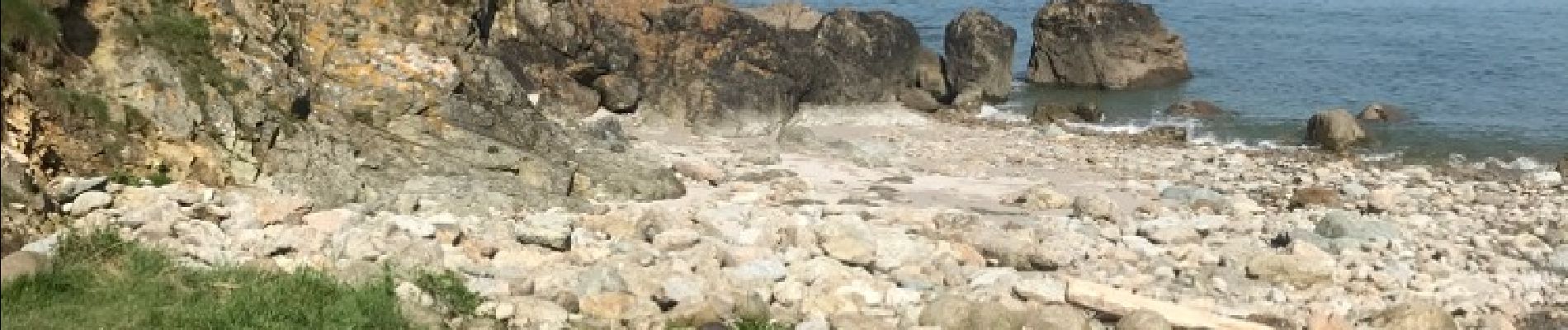
Trail Walking of 1.2 km to be discovered at Brittany, Côtes-d'Armor, Lamballe-Armor. This trail is proposed by babeth35.
Photos


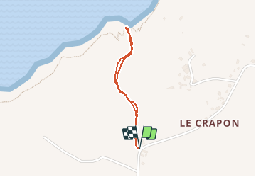
Positioning
Country:
France
Region :
Brittany
Department/Province :
Côtes-d'Armor
Municipality :
Lamballe-Armor
Location:
Planguenoual
Start:(Dec)
Start:(UTM)
528308 ; 5376388 (30U) N.
Comments