


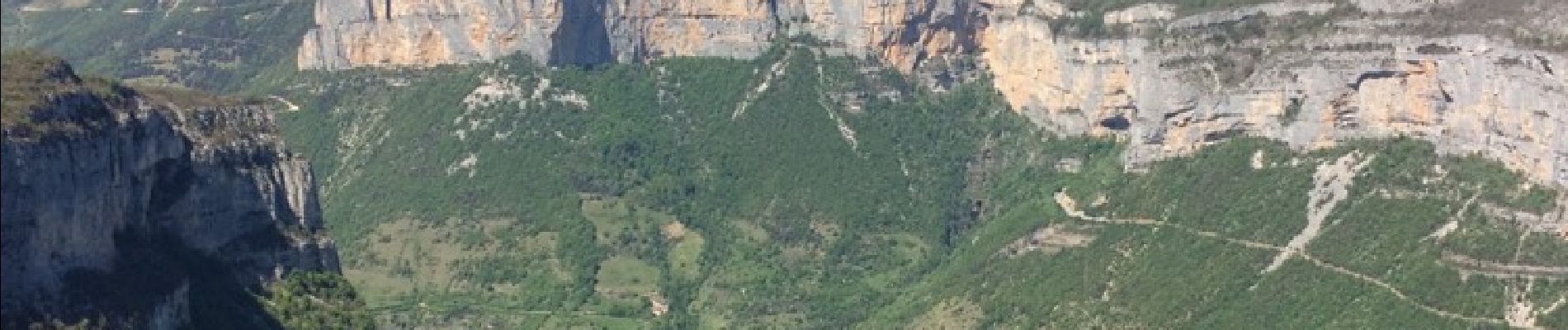
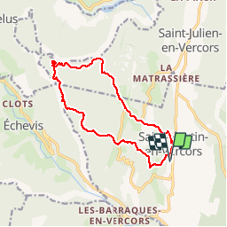
St Martin Pas de l'Allier crêtes du Bournillon

ajd26
User

Length
14.4 km

Max alt
1276 m

Uphill gradient
719 m
Km-Effort
24 km

Min alt
744 m

Downhill gradient
720 m
Boucle
Yes
Creation date :
2019-05-19 18:03:34.95
Updated on :
2019-05-19 18:03:35.758
4h04
Difficulty : Easy

FREE GPS app for hiking
 SityTrail
IGN / Geographical institutes
SityTrail Plus
The world is yours!
About
Trail Walking of 14.4 km to be discovered at Auvergne-Rhône-Alpes, Drôme, Saint-Martin-en-Vercors. This trail is proposed by ajd26.
Description
Dénivelé 700m environ
Photos

Positioning
Country:
France
Region :
Auvergne-Rhône-Alpes
Department/Province :
Drôme
Municipality :
Saint-Martin-en-Vercors
Location:
Unknown
Start:(Dec)
Start:(UTM)
692377 ; 4987743 (31T) N.
Comments