


du Caylar à la Couvertoirade

amiral13
User GUIDE
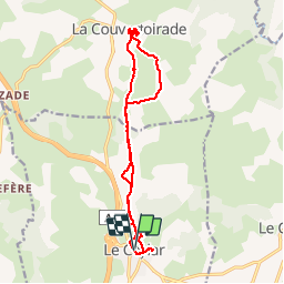

Length
16 km

Max alt
828 m

Uphill gradient
300 m
Km-Effort
20 km

Min alt
726 m

Downhill gradient
300 m
Boucle
Yes
Creation date :
2018-06-26 12:40:05.34
Updated on :
2018-06-26 12:40:05.34
5h45
Difficulty : Unknown

FREE GPS app for hiking
 SityTrail
IGN / Geographical institutes
SityTrail Plus
The world is yours!
About
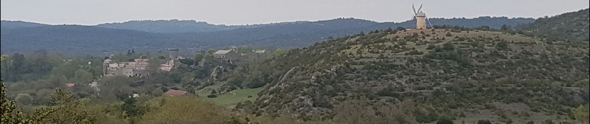
Trail Walking of 16 km to be discovered at Occitania, Hérault, Le Caylar. This trail is proposed by amiral13.
Description
Une randonnée dans le paysage typique du Larsac, avec la citée médiévale de la Couvertoirade en point d'orgue.
Possibilité d'allonger la randonnée en passant par le hameau du Cros.
Photos


Positioning
Country:
France
Region :
Occitania
Department/Province :
Hérault
Municipality :
Le Caylar
Location:
Unknown
Start:(Dec)
Start:(UTM)
525564 ; 4856810 (31T) N.
Comments