Trail Other activity Chapareillan - chapareillan col du granier 1900 d+ - Photo

chapareillan col du granier 1900 d+

 starco
starco

User

© OpenStreetMap contributors
Length
Length
44 km
Max alt
Max alt
1210 m
Uphill gradient
Uphill gradient
1787 m
Km-Effort
Km-Effort  
68 km
Min alt
Min alt
268 m
Downhill gradient
Downhill gradient
1782 m
Boucle
Boucle
Yes
Creation date :
2018-06-26 12:50:48.837
Updated on :
2018-06-26 12:50:48.837

(0 Reviews)

Other activity
Other activity
--
Difficulty : Unknown

Scan this QR Code to open this trail in the SityTrail application

FREE GPS app for hiking

Logo SityTrail SityTrail

IGN / Geographical institutes

Download SityTrail from the App Store Download SityTrail from Google Play

Logo SityTrail SityTrail World

The world is yours!

Download SityTrail from the App Store Download SityTrail from Google Play Download SityTrail on Huawei AppGallery

About

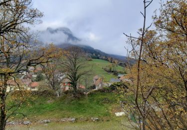
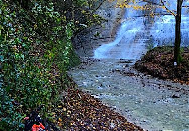
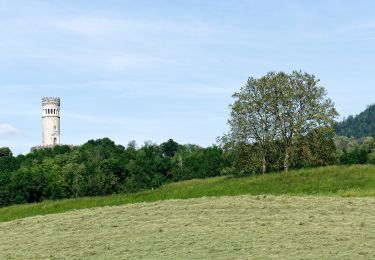
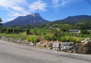
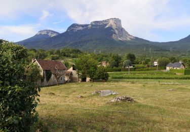
Trail Other activity of 44 km to be discovered at Auvergne-Rhône-Alpes, Isère, Chapareillan. This trail is proposed by starco.

Description

Belle rando, mais a faire par temps sec!

Elevation profile

Positioning

Country:
France
Region :
Auvergne-Rhône-Alpes
Department/Province :
Isère
Municipality :
Chapareillan
Location:
Unknown
Start:(Dec)
Start:(UTM)
733534 ; 5039275 (31T) N.

Trails nearby

Trail Walking Chapareillan - Le Mont Granier 1933m, depuis Bellecombe - Photo
Walking
tracegps

Walking

Difficult
(1)
Chapareillan, Auvergne-Rhône-Alpes, Isère, France
14.8 km | 35 km-effort
8h 45min
Yes
Trail Walking Chapareillan - Le Granier 1933m, par les pas de la Porte et de Bellecombe - Photo
Walking
tracegps

Walking

Difficult
(1)
Chapareillan, Auvergne-Rhône-Alpes, Isère, France
13.2 km | 30 km-effort
7h 30min
Yes
Trail Walking Barraux - Traversée Barraux - lac de St-André - Photo
Walking
GuyVachet

Walking

Difficult
Barraux, Auvergne-Rhône-Alpes, Isère, France
18.1 km | 28 km-effort
6h 30min
No
Trail Mountain bike Porte-de-Savoie - Les coteaux d'Apremont - Photo
Mountain bike
Levillefranchois

Mountain bike

Difficult
Porte-de-Savoie, Auvergne-Rhône-Alpes, Savoy, France
27 km | 37 km-effort
2h 32min
Yes
Trail On foot Saint-Maximin - Randonnée des Hameaux - Photo
On foot
PRO

On foot

Easy
Saint-Maximin, Auvergne-Rhône-Alpes, Isère, France
5.1 km | 8.1 km-effort
1h 50min
Yes
Trail Walking Apremont - 20190830 - Golf et Lac des Pères - Photo
Walking
Jfumomo

Walking

Easy
Apremont, Auvergne-Rhône-Alpes, Savoy, France
6.8 km | 7.4 km-effort
1h 15min
Yes
Trail Walking Apremont - 20190816 - Bélisay (Myans) - Photo
Walking
Jfumomo

Walking

Medium
Apremont, Auvergne-Rhône-Alpes, Savoy, France
8.3 km | 9.3 km-effort
1h 35min
Yes
Trail Walking Apremont - 20190814 - Lac Saint André - Photo
Walking
Jfumomo

Walking

Easy
Apremont, Auvergne-Rhône-Alpes, Savoy, France
7.9 km | 9.5 km-effort
1h 36min
Yes
Trail Walking Apremont - 180823-Pierre Hâchée - Photo
Walking
Jfumomo

Walking

Easy
Apremont, Auvergne-Rhône-Alpes, Savoy, France
6.9 km | 7.8 km-effort
1h 19min
Yes


Close
My subscriptions