


Les Campbels -cirque Navacelles

soca
User
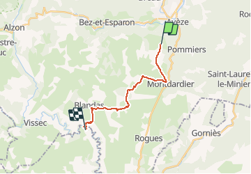

Length
16.4 km

Max alt
671 m

Uphill gradient
232 m
Km-Effort
21 km

Min alt
329 m

Downhill gradient
553 m
Boucle
No
Creation date :
2018-06-26 12:59:44.298
Updated on :
2018-06-26 12:59:44.298
4h16
Difficulty : Medium

FREE GPS app for hiking
 SityTrail
IGN / Geographical institutes
SityTrail Plus
The world is yours!
About
Trail Walking of 16.4 km to be discovered at Occitania, Gard, Montdardier. This trail is proposed by soca.
Positioning
Country:
France
Region :
Occitania
Department/Province :
Gard
Municipality :
Montdardier
Location:
Unknown
Start:(Dec)
Start:(UTM)
546857 ; 4867082 (31T) N.
Comments