


boucle moriensart

PhilippeHernaut
User
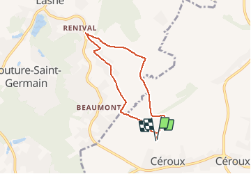

Length
5.7 km

Max alt
138 m

Uphill gradient
56 m
Km-Effort
6.5 km

Min alt
114 m

Downhill gradient
55 m
Boucle
Yes
Creation date :
2018-06-26 13:18:20.347
Updated on :
2018-06-26 13:18:20.347
1h16
Difficulty : Medium

FREE GPS app for hiking
 SityTrail
IGN / Geographical institutes
SityTrail Plus
The world is yours!
About
Trail Other activity of 5.7 km to be discovered at Wallonia, Walloon Brabant, Ottignies-Louvain-la-Neuve. This trail is proposed by PhilippeHernaut.
Positioning
Country:
Belgium
Region :
Wallonia
Department/Province :
Walloon Brabant
Municipality :
Ottignies-Louvain-la-Neuve
Location:
Céroux-Mousty
Start:(Dec)
Start:(UTM)
606777 ; 5613573 (31U) N.
Comments