


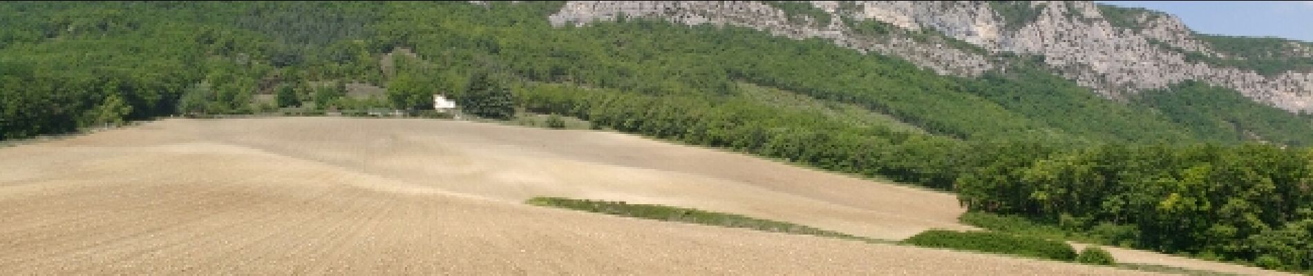
la bastide du quinson foret de saou

Nad38
User
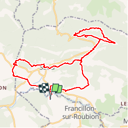

Length
23 km

Max alt
477 m

Uphill gradient
458 m
Km-Effort
29 km

Min alt
301 m

Downhill gradient
459 m
Boucle
Yes
Creation date :
2018-06-26 13:31:15.756
Updated on :
2018-06-26 13:31:15.756
4h36
Difficulty : Easy

FREE GPS app for hiking
 SityTrail
IGN / Geographical institutes
SityTrail Plus
The world is yours!
About
Trail Equestrian of 23 km to be discovered at Auvergne-Rhône-Alpes, Drôme, Francillon-sur-Roubion. This trail is proposed by Nad38.
Photos


Positioning
Country:
France
Region :
Auvergne-Rhône-Alpes
Department/Province :
Drôme
Municipality :
Francillon-sur-Roubion
Location:
Unknown
Start:(Dec)
Start:(UTM)
663801 ; 4943927 (31T) N.
Comments