


LOUBRESSAC - Lot

AndreLACOMBE
User

Length
17.7 km

Max alt
386 m

Uphill gradient
392 m
Km-Effort
23 km

Min alt
127 m

Downhill gradient
392 m
Boucle
Yes
Creation date :
2018-06-26 13:31:50.656
Updated on :
2018-06-26 13:31:50.656
6h44
Difficulty : Difficult

FREE GPS app for hiking
 SityTrail
IGN / Geographical institutes
SityTrail Plus
The world is yours!
About
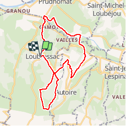
Trail Walking of 17.7 km to be discovered at Occitania, Lot, Loubressac. This trail is proposed by AndreLACOMBE.
Description
Cascade et crêtes d'AUTOIRE
Positioning
Country:
France
Region :
Occitania
Department/Province :
Lot
Municipality :
Loubressac
Location:
Unknown
Start:(Dec)
Start:(UTM)
405467 ; 4969332 (31T) N.
Comments