Montaiguet

mic-13
User
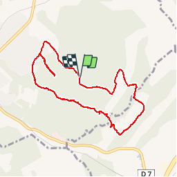

Length
9.2 km

Max alt
317 m

Uphill gradient
252 m
Km-Effort
12.6 km

Min alt
205 m

Downhill gradient
257 m
Boucle
Yes
Creation date :
2019-04-23 15:55:31.941
Updated on :
2019-04-23 15:55:31.998
1h54
Difficulty : Easy

FREE GPS app for hiking
 SityTrail
IGN / Geographical institutes
SityTrail Plus
The world is yours!
About
Trail Walking of 9.2 km to be discovered at Provence-Alpes-Côte d'Azur, Bouches-du-Rhône, Aix-en-Provence. This trail is proposed by mic-13.
Positioning
Country:
France
Region :
Provence-Alpes-Côte d'Azur
Department/Province :
Bouches-du-Rhône
Municipality :
Aix-en-Provence
Location:
Unknown
Start:(Dec)
Start:(UTM)
697763 ; 4817514 (31T) N.
Comments