


Vitrolle

ARPF
User
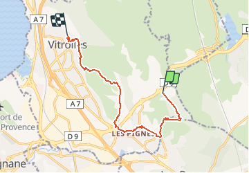

Length
12.1 km

Max alt
181 m

Uphill gradient
204 m
Km-Effort
14.7 km

Min alt
68 m

Downhill gradient
191 m
Boucle
No
Creation date :
2018-06-26 14:04:29.505
Updated on :
2018-06-26 14:04:29.505
--
Difficulty : Easy

FREE GPS app for hiking
 SityTrail
IGN / Geographical institutes
SityTrail Plus
The world is yours!
About
Trail Walking of 12.1 km to be discovered at Provence-Alpes-Côte d'Azur, Bouches-du-Rhône, Vitrolles. This trail is proposed by ARPF.
Positioning
Country:
France
Region :
Provence-Alpes-Côte d'Azur
Department/Province :
Bouches-du-Rhône
Municipality :
Vitrolles
Location:
Unknown
Start:(Dec)
Start:(UTM)
685797 ; 4812413 (31T) N.
Comments