


03.05.18 Astorga--Foncebadon

donda
User GUIDE

Length
26 km

Max alt
1430 m

Uphill gradient
626 m
Km-Effort
33 km

Min alt
855 m

Downhill gradient
68 m
Boucle
No
Creation date :
2018-06-26 14:14:42.668
Updated on :
2018-08-27 14:18:44.207
7h25
Difficulty : Difficult

FREE GPS app for hiking
 SityTrail
IGN / Geographical institutes
SityTrail Plus
The world is yours!
About
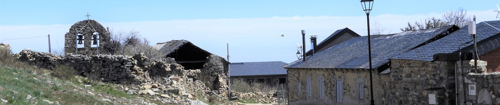
Trail Walking of 26 km to be discovered at Castile and León, Unknown, Astorga. This trail is proposed by donda.
Photos


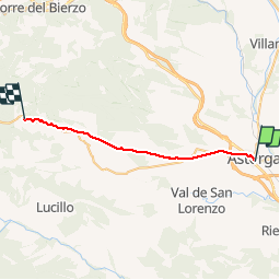
Positioning
Country:
Spain
Region :
Castile and León
Department/Province :
Unknown
Municipality :
Astorga
Location:
Unknown
Start:(Dec)
Start:(UTM)
742462 ; 4704290 (29T) N.
Comments