


sources de l'Huveaune

bernir
User

Length
11.3 km

Max alt
601 m

Uphill gradient
348 m
Km-Effort
15.9 km

Min alt
397 m

Downhill gradient
348 m
Boucle
Yes
Creation date :
2018-06-26 14:18:42.915
Updated on :
2018-06-26 14:18:42.915
5h24
Difficulty : Easy

FREE GPS app for hiking
 SityTrail
IGN / Geographical institutes
SityTrail Plus
The world is yours!
About
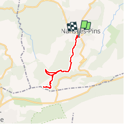
Trail Walking of 11.3 km to be discovered at Provence-Alpes-Côte d'Azur, Var, Nans-les-Pins. This trail is proposed by bernir.
Positioning
Country:
France
Region :
Provence-Alpes-Côte d'Azur
Department/Province :
Var
Municipality :
Nans-les-Pins
Location:
Unknown
Start:(Dec)
Start:(UTM)
725490 ; 4805704 (31T) N.
Comments