


20180516 Le Val-Cuit rando réelle

Sugg
User

Length
14.4 km

Max alt
520 m

Uphill gradient
521 m
Km-Effort
21 km

Min alt
241 m

Downhill gradient
521 m
Boucle
Yes
Creation date :
2019-03-22 16:57:57.939
Updated on :
2019-03-22 16:57:58.077
6h14
Difficulty : Medium

FREE GPS app for hiking
 SityTrail
IGN / Geographical institutes
SityTrail Plus
The world is yours!
About
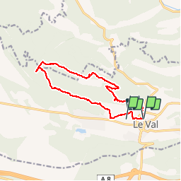
Trail Walking of 14.4 km to be discovered at Provence-Alpes-Côte d'Azur, Var, Le Val. This trail is proposed by Sugg.
Description
Rando RF guidée par Pierre.
Gr 653a et Le Cuit en 539, et retour par ND de Paracole
Photos


Positioning
Country:
France
Region :
Provence-Alpes-Côte d'Azur
Department/Province :
Var
Municipality :
Le Val
Location:
Unknown
Start:(Dec)
Start:(UTM)
263084 ; 4813965 (32T) N.
Comments