


vialenq pagax flagnac

yves12
User
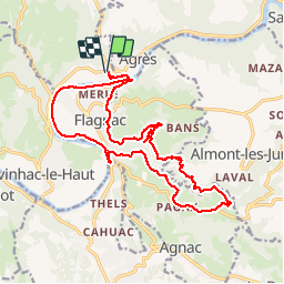

Length
20 km

Max alt
369 m

Uphill gradient
510 m
Km-Effort
27 km

Min alt
181 m

Downhill gradient
510 m
Boucle
Yes
Creation date :
2018-06-26 14:33:21.34
Updated on :
2018-06-26 14:33:21.34
4h25
Difficulty : Medium

FREE GPS app for hiking
 SityTrail
IGN / Geographical institutes
SityTrail Plus
The world is yours!
About
Trail Walking of 20 km to be discovered at Occitania, Aveyron, Saint-Santin. This trail is proposed by yves12.
Positioning
Country:
France
Region :
Occitania
Department/Province :
Aveyron
Municipality :
Saint-Santin
Location:
Unknown
Start:(Dec)
Start:(UTM)
440465 ; 4940353 (31T) N.
Comments