Trail Walking Dosches - Dosches (bon) le 21-05-2018 - Photo

Dosches (bon) le 21-05-2018

© OpenStreetMap contributors
Length
Length
12.9 km
Max alt
Max alt
147 m
Uphill gradient
Uphill gradient
111 m
Km-Effort
Km-Effort  
14.4 km
Min alt
Min alt
119 m
Downhill gradient
Downhill gradient
111 m
Boucle
Boucle
Yes
Creation date :
2018-06-26 14:39:16.784
Updated on :
2018-06-26 14:39:16.784

(0 Reviews)

Walking
Walking
3h09
Difficulty : Medium

Scan this QR Code to open this trail in the SityTrail application

FREE GPS app for hiking

Logo SityTrail SityTrail

IGN / Geographical institutes

Download SityTrail from the App Store Download SityTrail from Google Play

Logo SityTrail SityTrail World

The world is yours!

Download SityTrail from the App Store Download SityTrail from Google Play Download SityTrail on Huawei AppGallery

About

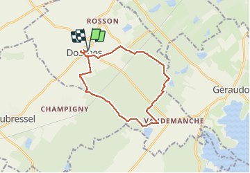
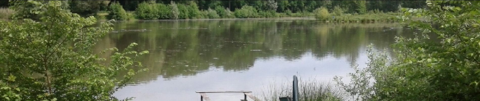
Trail Walking of 12.9 km to be discovered at Grand Est, Aube, Dosches. This trail is proposed by francis1952.

Elevation profile

Photos

Points of interest

Point of interest Géraudot - 8km Etang - Photo
francis1952
GÉRAUDOT 

Positioning

Country:
France
Region :
Grand Est
Department/Province :
Aube
Municipality :
Dosches
Location:
Unknown
Start:(UTM)
592796 ; 5352763 (31U) N.

Trails nearby

Trail Walking Dosches - balcon du parque  - Photo
Walking
danpar

Walking

Very difficult
(1)
Dosches, Grand Est, Aube, France
20 km | 24 km-effort
5h 23min
Yes
Trail Walking Rouilly-Sacey - Sacey Resson 16,6km le 25.03.2022 - Photo
Walking
francis1952

Walking

Easy
Rouilly-Sacey, Grand Est, Aube, France
16.6 km | 18.3 km-effort
3h 18min
Yes
Trail Walking Laubressel - Champigny 13,5km le 19.10.2021 - Photo
Walking
francis1952

Walking

Medium
Laubressel, Grand Est, Aube, France
13.5 km | 14.9 km-effort
3h 2min
Yes
Trail Walking Dosches - Dosches - Photo
Walking
danpar

Walking

Very difficult
Dosches, Grand Est, Aube, France
20 km | 24 km-effort
5h 23min
Yes
Trail Walking Laubressel - Messon rte d'Eyret - Photo
Walking
jacky rahir

Walking

Very difficult
Laubressel, Grand Est, Aube, France
126 km | 144 km-effort
73h 46min
No
Trail Walking Laubressel - Laubressel Patrick - Photo
Walking
DMathieu10

Walking

Difficult
Laubressel, Grand Est, Aube, France
12.2 km | 14.3 km-effort
3h 15min
No
Trail Nordic walking Mesnil-Sellières - Mesnil st pere - Photo
Nordic walking
DMathieu10

Nordic walking

Very easy
Mesnil-Sellières, Grand Est, Aube, France
11.7 km | 13.5 km-effort
2h 33min
Yes
Trail Walking Laubressel - champigny FPE - Photo
Walking
DMathieu10

Walking

Very easy
Laubressel, Grand Est, Aube, France
11.8 km | 13 km-effort
2h 51min
Yes
Trail Walking Laubressel - Laubressel patrick - Photo
Walking
DMathieu10

Walking

Difficult
Laubressel, Grand Est, Aube, France
12.2 km | 14.3 km-effort
2h 40min
No


Close
My subscriptions