Trail Walking Collobrières - Collobrière Chartreuse de la Verne  - Photo

Collobrière Chartreuse de la Verne

 BerFran
BerFran

User

© OpenStreetMap contributors
Length
Length
16 km
Max alt
Max alt
598 m
Uphill gradient
Uphill gradient
462 m
Km-Effort
Km-Effort  
22 km
Min alt
Min alt
309 m
Downhill gradient
Downhill gradient
462 m
Boucle
Boucle
Yes
Creation date :
2018-06-26 14:56:33.023
Updated on :
2021-02-22 18:50:59.564

(0 Reviews)

Walking
Walking
5h29
Difficulty : Easy

Scan this QR Code to open this trail in the SityTrail application

FREE GPS app for hiking

Logo SityTrail SityTrail

IGN / Geographical institutes

Download SityTrail from the App Store Download SityTrail from Google Play

Logo SityTrail SityTrail Plus

The world is yours!

Download SityTrail from the App Store Download SityTrail from Google Play Download SityTrail on Huawei AppGallery

About

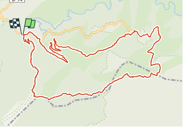
Trail Walking of 16 km to be discovered at Provence-Alpes-Côte d'Azur, Var, Collobrières. This trail is proposed by BerFran.

Description

Passer par le village de Collobrière,prendre la route direction Chartreuse de la Verne( ne pas monter jusqu'à la Chartreuse) continuer la route jusqu'au parking de La Croix d'anselme, se garer plutôt au bord de la route pour attraper le chemin de départ (au niveau du Gué)

Elevation profile

Positioning

Country:
France
Region :
Provence-Alpes-Côte d'Azur
Department/Province :
Var
Municipality :
Collobrières
Location:
Unknown
Start:(UTM)
285858 ; 4790205 (32T) N.


Close
My subscriptions