


cirque de l'infernet

bernir
User
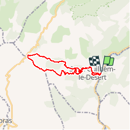

Length
14.2 km

Max alt
560 m

Uphill gradient
632 m
Km-Effort
23 km

Min alt
75 m

Downhill gradient
631 m
Boucle
Yes
Creation date :
2018-06-26 15:01:47.905
Updated on :
2018-06-26 15:01:47.905
5h56
Difficulty : Medium

FREE GPS app for hiking
 SityTrail
IGN / Geographical institutes
SityTrail Plus
The world is yours!
About
Trail Walking of 14.2 km to be discovered at Occitania, Hérault, Saint-Guilhem-le-Désert. This trail is proposed by bernir.


Positioning
Country:
France
Region :
Occitania
Department/Province :
Hérault
Municipality :
Saint-Guilhem-le-Désert
Location:
Unknown
Start:(Dec)
Start:(UTM)
544681 ; 4842512 (31T) N.
Comments