


Ténérife - El Gonde

cron
User

Length
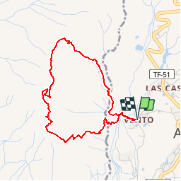
5.2 km

Max alt
987 m

Uphill gradient
392 m
Km-Effort
10.4 km

Min alt
610 m

Downhill gradient
391 m
Boucle
Yes
Creation date :
2018-06-26 15:12:41.678
Updated on :
2018-06-26 15:12:41.678
2h05
Difficulty : Easy

FREE GPS app for hiking
 SityTrail
IGN / Geographical institutes
SityTrail Plus
The world is yours!
About
Trail Walking of 5.2 km to be discovered at Canary Islands, Santa Cruz de Tenerife, Arona. This trail is proposed by cron.
Positioning
Country:
Spain
Region :
Canary Islands
Department/Province :
Santa Cruz de Tenerife
Municipality :
Arona
Location:
Unknown
Start:(Dec)
Start:(UTM)
334215 ; 3109547 (28R) N.
Comments