


via rhona j3

ericf64
User
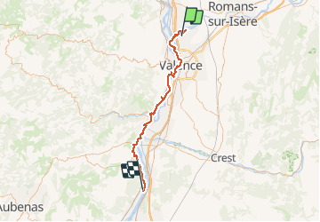

Length
67 km

Max alt
137 m

Uphill gradient
397 m
Km-Effort
73 km

Min alt
79 m

Downhill gradient
434 m
Boucle
No
Creation date :
2018-06-26 15:15:48.672
Updated on :
2019-08-30 10:12:30.245
--
Difficulty : Easy

FREE GPS app for hiking
 SityTrail
IGN / Geographical institutes
SityTrail Plus
The world is yours!
About
Trail Bicycle tourism of 67 km to be discovered at Auvergne-Rhône-Alpes, Drôme, Châteauneuf-sur-Isère. This trail is proposed by ericf64.
Description
camping cruas
Positioning
Country:
France
Region :
Auvergne-Rhône-Alpes
Department/Province :
Drôme
Municipality :
Châteauneuf-sur-Isère
Location:
Unknown
Start:(Dec)
Start:(UTM)
649203 ; 4984404 (31T) N.
Comments