


Rando des lacs 2018

fabwin
User GUIDE

Length
45 km

Max alt
493 m

Uphill gradient
895 m
Km-Effort
57 km

Min alt
311 m

Downhill gradient
896 m
Boucle
Yes
Creation date :
2018-06-26 15:32:07.265
Updated on :
2018-06-26 15:32:07.265
3h35
Difficulty : Difficult

FREE GPS app for hiking
 SityTrail
IGN / Geographical institutes
SityTrail Plus
The world is yours!
About
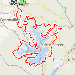
Trail Mountain bike of 45 km to be discovered at Grand Est, Meurthe-et-Moselle, Badonviller. This trail is proposed by fabwin.
Description
Rando 2018 avec Séb, Luca et Ange
SUper météo et un beau parcours!!
Positioning
Country:
France
Region :
Grand Est
Department/Province :
Meurthe-et-Moselle
Municipality :
Badonviller
Location:
Unknown
Start:(Dec)
Start:(UTM)
344329 ; 5373618 (32U) N.
Comments