


Chavagne_est
© OpenStreetMap contributors


13m
Difficulty : Easy


Length
7.6 km
Max alt
40 m
Uphill gradient
41 m
Km-Effort
8.1 km
Min alt
21 m
Downhill gradient
46 m
Boucle
No
Creation date :
2018-06-26 16:05:48.647
Updated on :
2018-06-26 16:05:48.647
13m
Difficulty : Easy
FREE GPS app for hiking
 SityTrail
IGN / Geographical institutes
SityTrail Plus
The world is yours!
About
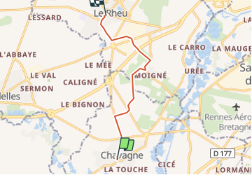
Trail Cycle of 7.6 km to be discovered at Brittany, Ille-et-Vilaine, Chavagne. This trail is proposed by yannick.juin@orange.fr.
Positioning
Country:
France
Region :
Brittany
Department/Province :
Ille-et-Vilaine
Municipality :
Chavagne
Location:
Unknown
Start:(Dec)
Start:(UTM)
590133 ; 5322838 (30U) N.
Comments