


2018-06-10 Limours 110 km

Lucquiaud
User
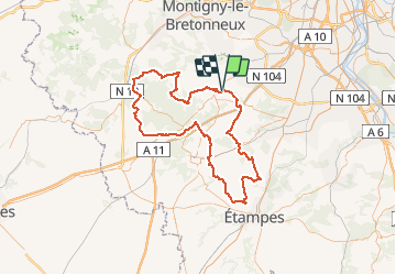

Length
111 km

Max alt
180 m

Uphill gradient
1150 m
Km-Effort
126 km

Min alt
63 m

Downhill gradient
1141 m
Boucle
Yes
Creation date :
2018-09-15 15:02:47.043
Updated on :
2018-09-15 15:02:47.538
7h24
Difficulty : Medium

FREE GPS app for hiking
 SityTrail
IGN / Geographical institutes
SityTrail Plus
The world is yours!
About
Trail Cycle of 111 km to be discovered at Ile-de-France, Essonne, Limours. This trail is proposed by Lucquiaud.
Positioning
Country:
France
Region :
Ile-de-France
Department/Province :
Essonne
Municipality :
Limours
Location:
Unknown
Start:(Dec)
Start:(UTM)
432336 ; 5388155 (31U) N.
Comments