


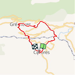
cipieres - greolieres - cipieres

elcanario
User

Length
7.4 km

Max alt
843 m

Uphill gradient
488 m
Km-Effort
13.9 km

Min alt
546 m

Downhill gradient
492 m
Boucle
Yes
Creation date :
2018-06-26 16:20:40.99
Updated on :
2018-06-26 16:20:40.99
3h49
Difficulty : Easy

FREE GPS app for hiking
 SityTrail
IGN / Geographical institutes
SityTrail Plus
The world is yours!
About
Trail Walking of 7.4 km to be discovered at Provence-Alpes-Côte d'Azur, Maritime Alps, Cipières. This trail is proposed by elcanario.
Description
circuit
Positioning
Country:
France
Region :
Provence-Alpes-Côte d'Azur
Department/Province :
Maritime Alps
Municipality :
Cipières
Location:
Unknown
Start:(Dec)
Start:(UTM)
335415 ; 4849809 (32T) N.
Comments