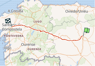
Compostelle 2018 - León -> Santiago

uru2010
User

Length
328 km

Max alt
1510 m

Uphill gradient
6426 m
Km-Effort
416 km

Min alt
245 m

Downhill gradient
6993 m
Boucle
No
Creation date :
2018-06-26 16:22:53.645
Updated on :
2022-05-08 15:21:18.687
82h15
Difficulty : Medium

FREE GPS app for hiking
 SityTrail
IGN / Geographical institutes
SityTrail Plus
The world is yours!
About
Trail Walking of 328 km to be discovered at Castile and León, Unknown, León. This trail is proposed by uru2010.
Description
Chemin de Compostelle en 2018:
León -> Santiago et Cee -> Fisterra
Positioning
Country:
Spain
Region :
Castile and León
Department/Province :
Unknown
Municipality :
León
Location:
Unknown
Start:(Dec)
Start:(UTM)
289302 ; 4719026 (30T) N.
Comments