Trail Walking Maizières - Randoguide - Photo
© OpenStreetMap contributors
Length
Length
9.4 km
Max alt
Max alt
392 m
Uphill gradient
Uphill gradient
257 m
Km-Effort
Km-Effort  
12.9 km
Min alt
Min alt
229 m
Downhill gradient
Downhill gradient
257 m
Boucle
Boucle
Yes
Creation date :
2014-12-10 00:00:00.0
Updated on :
2014-12-10 00:00:00.0

(2 Reviews)

Walking
Walking
2h19
Difficulty : Medium

Scan this QR Code to open this trail in the SityTrail application

FREE GPS app for hiking

Logo SityTrail SityTrail

IGN / Geographical institutes

Download SityTrail from the App Store Download SityTrail from Google Play

Logo SityTrail SityTrail World

The world is yours!

Download SityTrail from the App Store Download SityTrail from Google Play Download SityTrail on Huawei AppGallery

About

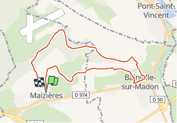
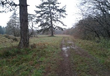
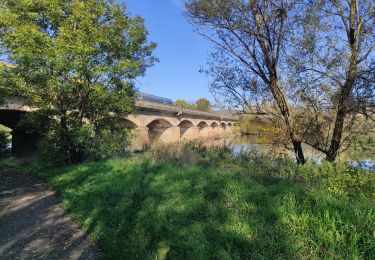
Trail Walking of 9.4 km to be discovered at Grand Est, Meurthe-et-Moselle, Maizières. This trail is proposed by virginieHurpeau.

Elevation profile

Positioning

Country:
France
Region :
Grand Est
Department/Province :
Meurthe-et-Moselle
Municipality :
Maizières
Location:
Unknown
Start:(UTM)
283373 ; 5385542 (32U) N.

Comments

Please log in to post a review or rate the element


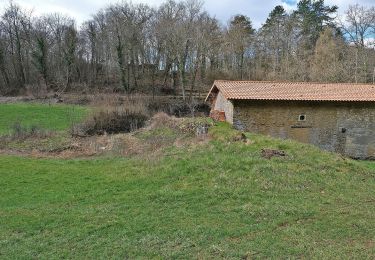
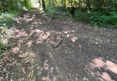
sympa dans cette grisaille Lorraine. il y a quelques geocaches sympas au départ.
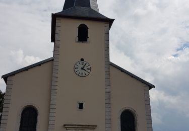
  

tres bon.


Trails nearby

Trail On foot Thuilley-aux-Groseilles - Circuit du Bois de Feys - Photo
On foot
PRO

On foot

Easy
Thuilley-aux-Groseilles, Grand Est, Meurthe-et-Moselle, France
10 km | 12.6 km-effort
2h 52min
No
Trail Walking Bainville-sur-Madon - Bainville sur Madon - Photo
Walking
joelclaudel

Walking

Medium
(3)
Bainville-sur-Madon, Grand Est, Meurthe-et-Moselle, France
18.3 km | 23 km-effort
4h 15min
Yes
Trail Walking Sexey-aux-Forges - Sexey Aux Forges - Photo
Walking
pgalet

Walking

Very difficult
Sexey-aux-Forges, Grand Est, Meurthe-et-Moselle, France
31 km | 38 km-effort
2h 38min
No
Trail Walking Bainville-sur-Madon - BAINVILLE SUR MADON - CIRCUIT VOIVRE ET JACQUES CALLOT - Photo
Walking
jean-marie.parachini

Walking

Medium
Bainville-sur-Madon, Grand Est, Meurthe-et-Moselle, France
19.8 km | 24 km-effort
5h 44min
Yes
Trail Walking Viterne - sentier des croix - Photo
Walking
Morel54

Walking

Very easy
(1)
Viterne, Grand Est, Meurthe-et-Moselle, France
11.6 km | 13.6 km-effort
3h 10min
Yes
Trail Walking Maizières - viterne du 14.12.2013 - Photo
Walking
castelli

Walking

Easy
(2)
Maizières, Grand Est, Meurthe-et-Moselle, France
7.6 km | 9.5 km-effort
2h 6min
No
Trail Walking Chaligny - Chaligny 1 - Photo
Walking
junglefood

Walking

Easy
(1)
Chaligny, Grand Est, Meurthe-et-Moselle, France
4.9 km | 6.3 km-effort
1h 20min
Yes
Trail Walking Neuves-Maisons - Audax Neuves Maisons  - Photo
Walking
Toyot 8

Walking

Difficult
Neuves-Maisons, Grand Est, Meurthe-et-Moselle, France
52 km | 59 km-effort
8h 42min
Yes
Trail On foot Viterne - Circuit des Sources - Photo
On foot
PRO

On foot

Easy
Viterne, Grand Est, Meurthe-et-Moselle, France
6.8 km | 8.3 km-effort
1h 53min
Yes


Close
My subscriptions