


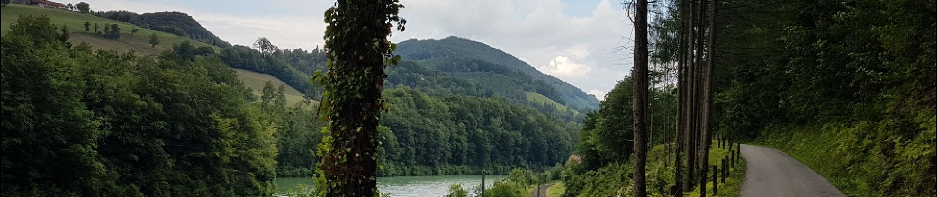
Mauthausen - Losenstein

karawatsj
User

Length
58 km

Max alt
382 m

Uphill gradient
769 m
Km-Effort
68 km

Min alt
236 m

Downhill gradient
657 m
Boucle
No
Creation date :
2018-06-26 16:38:01.517
Updated on :
2018-06-26 16:38:01.517
3h52
Difficulty : Medium

FREE GPS app for hiking
 SityTrail
IGN / Geographical institutes
SityTrail Plus
The world is yours!
About
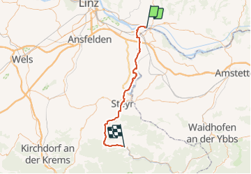
Trail Cycle of 58 km to be discovered at Upper Austria, Bezirk Perg, Mauthausen. This trail is proposed by karawatsj.
Photos


Positioning
Country:
Austria
Region :
Upper Austria
Department/Province :
Bezirk Perg
Municipality :
Mauthausen
Location:
Unknown
Start:(Dec)
Start:(UTM)
464146 ; 5343079 (33U) N.
Comments