


2018-06-22 ardechoise

Lucquiaud
User
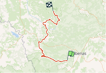

Length
112 km

Max alt
1441 m

Uphill gradient
3125 m
Km-Effort
150 km

Min alt
295 m

Downhill gradient
2110 m
Boucle
No
Creation date :
2018-09-15 15:02:44.891
Updated on :
2018-09-15 15:02:44.936
9h34
Difficulty : Very difficult

FREE GPS app for hiking
 SityTrail
IGN / Geographical institutes
SityTrail Plus
The world is yours!
About
Trail Cycle of 112 km to be discovered at Auvergne-Rhône-Alpes, Ardèche, Rocher. This trail is proposed by Lucquiaud.
Description
circuit 3 jours le Tanargue - Lignon
partie 2 Roche / les Estables
Positioning
Country:
France
Region :
Auvergne-Rhône-Alpes
Department/Province :
Ardèche
Municipality :
Rocher
Location:
Unknown
Start:(Dec)
Start:(UTM)
602106 ; 4936454 (31T) N.
Comments