


Vallée de la Clarée.

AndreLACOMBE
User
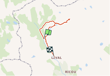

Length
10.9 km

Max alt
2590 m

Uphill gradient
478 m
Km-Effort
17.7 km

Min alt
2020 m

Downhill gradient
599 m
Boucle
No
Creation date :
2019-01-15 12:09:53.076
Updated on :
2019-01-15 12:09:53.076
6h03
Difficulty : Medium

FREE GPS app for hiking
 SityTrail
IGN / Geographical institutes
SityTrail Plus
The world is yours!
About
Trail Walking of 10.9 km to be discovered at Provence-Alpes-Côte d'Azur, Hautes-Alpes, Névache. This trail is proposed by AndreLACOMBE.
Description
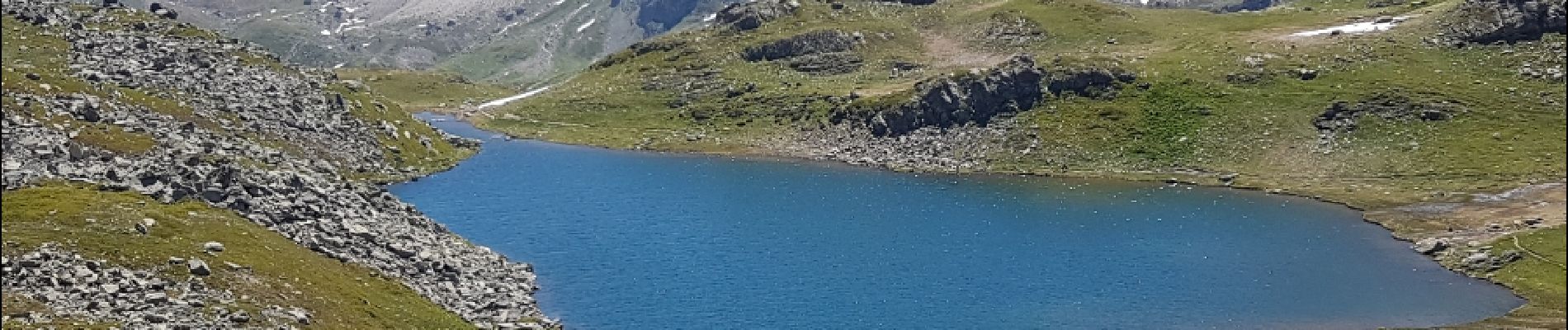
Chalets de Laval, Drayères, Lac Rond, Lac des Muandes, Lac Rond, Lac Long et retour.
Photos


Positioning
Country:
France
Region :
Provence-Alpes-Côte d'Azur
Department/Province :
Hautes-Alpes
Municipality :
Névache
Location:
Unknown
Start:(Dec)
Start:(UTM)
304359 ; 4994020 (32T) N.
Comments