


Andorre 2

murph
User
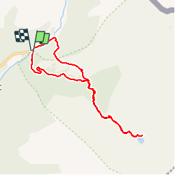

Length
8.5 km

Max alt
2349 m

Uphill gradient
656 m
Km-Effort
17.3 km

Min alt
1786 m

Downhill gradient
662 m
Boucle
Yes
Creation date :
2019-01-15 12:21:33.443
Updated on :
2019-12-22 15:18:12.956
6h16
Difficulty : Unknown

FREE GPS app for hiking
 SityTrail
IGN / Geographical institutes
SityTrail Plus
The world is yours!
About
Trail Other activity of 8.5 km to be discovered at Andorra. This trail is proposed by murph.
Positioning
Country:
Andorra
Region :
Ordino
Department/Province :
Ordino
Municipality :
el Serrat
Location:
Unknown
Start:(Dec)
Start:(UTM)
381256 ; 4720274 (31T) N.
Comments