


29.01.2012.Le Tronchet/Forêt du Mesnil.12 k. - 12h23m08

babeth35
User
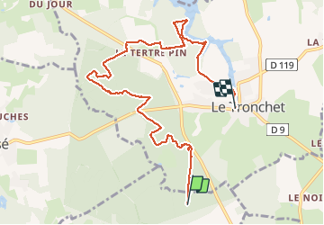

Length
8.9 km

Max alt
74 m

Uphill gradient
87 m
Km-Effort
10.1 km

Min alt
45 m

Downhill gradient
96 m
Boucle
No
Creation date :
2014-12-10 00:00:00.0
Updated on :
2020-07-20 16:21:17.847
2h26
Difficulty : Very easy

FREE GPS app for hiking
 SityTrail
IGN / Geographical institutes
SityTrail Plus
The world is yours!
About
Trail Walking of 8.9 km to be discovered at Brittany, Ille-et-Vilaine, Mesnil-Roc'h. This trail is proposed by babeth35.
Description
Interruption dans le parcours
Positioning
Country:
France
Region :
Brittany
Department/Province :
Ille-et-Vilaine
Municipality :
Mesnil-Roc'h
Location:
Saint-Pierre-de-Plesguen
Start:(Dec)
Start:(UTM)
585174 ; 5369638 (30U) N.
Comments