


Embrun - 3.4km 90m 1h00 - 2018 06 26 - privé

Orcal37
User GUIDE
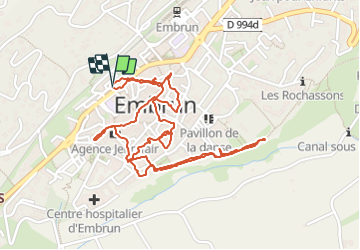

Length
3.1 km

Max alt
878 m

Uphill gradient
73 m
Km-Effort
4.1 km

Min alt
814 m

Downhill gradient
73 m
Boucle
Yes
Creation date :
2019-01-15 12:35:08.72
Updated on :
2021-09-20 18:00:13.232
1h15
Difficulty : Very easy

FREE GPS app for hiking
 SityTrail
IGN / Geographical institutes
SityTrail Plus
The world is yours!
About
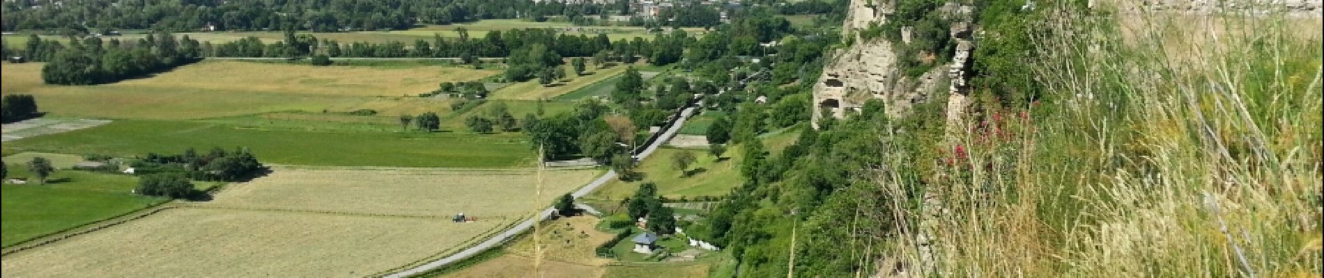
Trail Walking of 3.1 km to be discovered at Provence-Alpes-Côte d'Azur, Hautes-Alpes, Embrun. This trail is proposed by Orcal37.
Description
Embrun - 3.4km 90m 1h00 - 2018 06 26 - privé
Photos


Positioning
Country:
France
Region :
Provence-Alpes-Côte d'Azur
Department/Province :
Hautes-Alpes
Municipality :
Embrun
Location:
Unknown
Start:(Dec)
Start:(UTM)
300998 ; 4937650 (32T) N.
Comments