


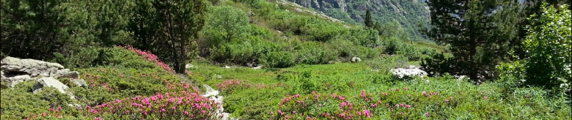
Oisans - La Bérarde Chatelleret - 11km 400m 3h25 - 2018 06 22 - public

Orcal37
User GUIDE
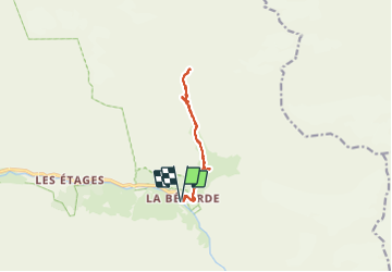

Length
10.8 km

Max alt
2041 m

Uphill gradient
393 m
Km-Effort
16 km

Min alt
1703 m

Downhill gradient
391 m
Boucle
Yes
Creation date :
2019-01-15 12:35:16.703
Updated on :
2021-09-20 17:36:09.432
5h30
Difficulty : Medium

FREE GPS app for hiking
 SityTrail
IGN / Geographical institutes
SityTrail Plus
The world is yours!
About
Trail Walking of 10.8 km to be discovered at Auvergne-Rhône-Alpes, Isère, Saint-Christophe-en-Oisans. This trail is proposed by Orcal37.
Description
Oisans - La Bérarde Chatelleret - 11km 400m 3h25 - 2018 06 22 - public
Photos


Positioning
Country:
France
Region :
Auvergne-Rhône-Alpes
Department/Province :
Isère
Municipality :
Saint-Christophe-en-Oisans
Location:
Unknown
Start:(Dec)
Start:(UTM)
286287 ; 4978962 (32T) N.
Comments