


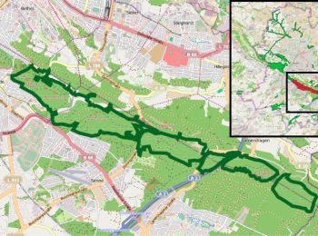
3,7 km | 4,5 km-effort
Bielefeld: Descubra las mejores excursiones: 52 a pie. Todos estos circuitos, recorridos, itinerarios y actividades al aire libre están disponibles en nuestras aplicaciones SityTrail para smartphone y tablet.
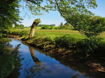
A pie


• Trail created by Teutoburger Wald Verband.
A pie
• Trail created by Teutoburger Wald Verband.
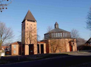
A pie
• Trail created by Teutoburger Wald Verband. Symbol: Schwarzer Grund mit Burg, geschwungener Weg, Bergen. Text "Burg z...
A pie
• Trail created by TERRA.vita. Symbol: Weißes Bergmannsymbol (Schlägel und Eisen) auf schwarzem Grund
A pie
• Trail created by Naturpark Südlicher Teutoburger Wald. Symbol: weiße Sanduhr und Ziffer 4 auf schwarzem Grund
A pie
• Trail created by Naturpark Südlicher Teutoburger Wald. Symbol: weiße Sanduhr und Ziffer 3 auf schwarzem Grund
A pie
• Trail created by Naturpark Südlicher Teutoburger Wald. Symbol: weiße Sanduhr und Ziffer 1 auf schwarzem Grund
A pie
• Trail created by Teutoburger-Wald-Verein. Symbol: weisse 9 in weisser Raute
A pie
• Trail created by Naturpark Südlicher Teutoburger Wald. Symbol: weiße Sanduhr und Ziffer 6 auf schwarzem Grund
A pie
• Trail created by Naturpark Südlicher Teutoburger Wald. Symbol: weiße Sanduhr und Ziffer 5 auf schwarzem Grund
A pie
• Trail created by Teutoburger-Wald-Verein. Sitio web: http://www.heimatverein-joellenbeck.de/joomla/index.php/menu-...
![Excursión A pie Desconocido - KulturLand Schelphof - Erlebsnispfad Land[wirt]schaft - Photo](https://media.geolcdn.com/t/350/260/ext.jpg?maxdim=2&url=https%3A%2F%2Fmedia.geolcdn.com%2Ff%2F947f6235-968b-46c8-85c0-3056399ced95.jpeg)
A pie
• Trail created by Naturpädagogisches Zentrum Schelphof e.V.. Symbol: Vier bunte Quadrate mit Hofsiluette Sitio web:...
A pie
• Trail created by Heimatverein Jöllenbeck. Der Weg ist nur noch im Zentrum von Jöllenbeck markiert. Die übrige Markie...
A pie
• Trail created by Heimatverein Jöllenbeck.
A pie
• Trail created by Heimatverein Jöllenbeck. Symbol: Weißer Punkt in weißer Raute auf schwarzem Rechteck
A pie
• Trail created by Heimatverein Jöllenbeck.
A pie
• Trail created by Heimatverein Jöllenbeck.
A pie
• Symbol: Weiße A9 auf schwarzen Grund
A pie
• Trail created by Teutoburger-Wald-Verein. Symbol: weisse 2 in weisser Raute
A pie
• Trail created by Teutoburger-Wald-Verein. Symbol: weisse 7 in weisser Raute
20 excursiones mostradas en 52
Aplicación GPS de excursión GRATIS
 SityTrail
IGN / Institutos geográficos
SityTrail World
El mundo es suyo