![](/images/other/stat-length.png)
![Excursión Carrera Abbeville - Chemin de la Somme - Photo](https://media.geolcdn.com/t/1900/400/ext.pjpeg?maxdim=2&url=https%3A%2F%2Fstatic1.geolcdn.com%2Fsiteimages%2Fupload%2Ffiles%2F1524743154running.jpg)
Chemin de la Somme
tracegps
Usuario
![Longitud](/images/other/stat-length.png)
Longitud
14,8 km
![Altitud máxima](https://static1.geolcdn.com/siteimages/upload/files/1508320355ic_sort_altitude_max_24dp.png)
Altitud máxima
75 m
![Desnivel positivo](https://static1.geolcdn.com/siteimages/upload/files/1508320355ic_sort_den_pos_24dp.png)
Desnivel positivo
118 m
![Km-Effort](/images/other/stat-length.png)
Km-Effort
16,4 km
![Altitud mínima](https://static1.geolcdn.com/siteimages/upload/files/1508320355ic_sort_altitude_min_24dp.png)
Altitud mínima
2 m
![Desnivel negativo](https://static1.geolcdn.com/siteimages/upload/files/1508320355ic_sort_den_neg_24dp.png)
Desnivel negativo
118 m
![Boucle](https://static1.geolcdn.com/siteimages/upload/files/16400158638029165_repeat_loop_refresh_sync_direction_icon.png)
Boucle
Sí
Fecha de creación :
2014-12-10 00:00:00.0
Última modificación :
2014-12-10 00:00:00.0
![Carrera](https://static1.geolcdn.com/sitytour/trail-icons/103.png)
1h19
Dificultad : Medio
![Escanee este código QR para abrir la excursión en la aplicación SityTrail](https://capi.geolives.com/qq0zvz2zws4bq2lad0pu/sitytour/trails/102605/qr.png?size=200)
Aplicación GPS de excursión GRATIS
A propósito
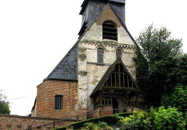
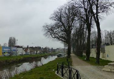
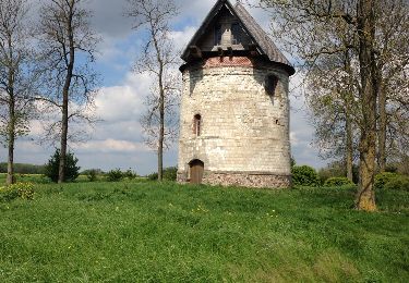
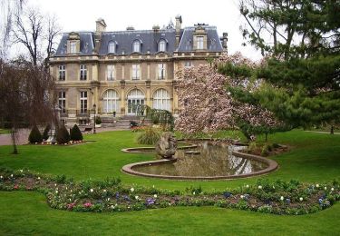
Ruta Carrera de 14,8 km a descubrir en Alta Francia, Somme, Abbeville. Esta ruta ha sido propuesta por tracegps.
Descripción
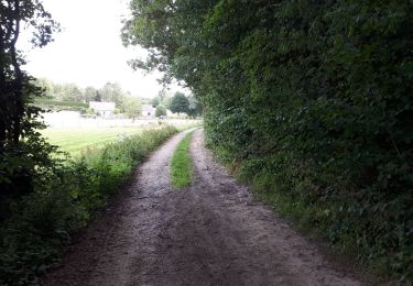
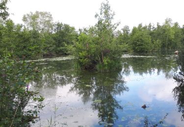
Une petite course à pied d'environ 15 km au départ d'Abbeville (zone industrielle) en passant sur le long de la Somme (chemin du Patis)
Localización
País:
France
Región :
Alta Francia
Departamento/provincia :
Somme
Municipio :
Abbeville
Localidad:
Unknown
Salida:(Dec)
Salida:(UTM)
418070 ; 5551468 (31U) N.
Comentarios
Excursiones cerca
![Excursión Senderismo Yonval - Les 3 Fétus - Yonval - Photo](https://media.geolcdn.com/t/375/260/ext.jpg?maxdim=2&url=https%3A%2F%2Fservices.sitytrail.com%2FGeolivesWS%2FDownloadMedia.ashx%3FTrailID%3D108581%26Media%3D1489_1.jpg)
![Senderismo Senderismo](https://static1.geolcdn.com/sitytour/trail-icons/101.png)
Les 3 Fétus - Yonval
Senderismo
Difícil
(2)
Yonval,
Alta Francia,
Somme,
France
![](/images/other/stat-length.png)
7,5 km | 9,4 km-effort
2h 30min
![](https://static1.geolcdn.com/siteimages/upload/files/16400158638029165_repeat_loop_refresh_sync_direction_icon.png)
Sí
![Excursión Senderismo Millencourt-en-Ponthieu - le fond de Millencourt - Photo](https://media.geolcdn.com/t/375/260/ext.jpg?maxdim=2&url=https%3A%2F%2Fmedia.geolcdn.com%2Ff%2F6f31d742-17fa-4bae-b416-69b40bf4966c.jpg)
![Senderismo Senderismo](https://static1.geolcdn.com/sitytour/trail-icons/101.png)
le fond de Millencourt
Senderismo
Muy fácil
Millencourt-en-Ponthieu,
Alta Francia,
Somme,
France
![](/images/other/stat-length.png)
7 km | 8,2 km-effort
2h 2min
![](https://static1.geolcdn.com/siteimages/upload/files/16400158638029165_repeat_loop_refresh_sync_direction_icon.png)
Sí
![Excursión Senderismo Mareuil-Caubert - Au travers des étangs - Photo](https://media.geolcdn.com/t/375/260/ext.jpg?maxdim=2&url=https%3A%2F%2Fmedia.geolcdn.com%2Ff%2F3d0ba1a8-2447-466c-a227-2f133fd97408.jpg)
![Senderismo Senderismo](https://static1.geolcdn.com/sitytour/trail-icons/101.png)
Au travers des étangs
Senderismo
Muy fácil
Mareuil-Caubert,
Alta Francia,
Somme,
France
![](/images/other/stat-length.png)
3,7 km | 3,9 km-effort
1h 16min
![](https://static1.geolcdn.com/siteimages/upload/files/16400158638029165_repeat_loop_refresh_sync_direction_icon.png)
Sí
![Excursión Bicicleta Abbeville - la baie de Somme à vélo - Photo](https://media.geolcdn.com/t/375/260/ext.jpg?maxdim=2&url=https%3A%2F%2Fservices.sitytrail.com%2FGeolivesWS%2FDownloadMedia.ashx%3FTrailID%3D1132041%26Media%3D20190407095358.jpg)
![Bicicleta Bicicleta](https://static1.geolcdn.com/sitytour/trail-icons/200.png)
la baie de Somme à vélo
Bicicleta
Muy fácil
Abbeville,
Alta Francia,
Somme,
France
![](/images/other/stat-length.png)
118 km | 124 km-effort
8h 12min
![](https://static1.geolcdn.com/siteimages/upload/files/16400158638029165_repeat_loop_refresh_sync_direction_icon.png)
No
![Excursión Senderismo Abbeville - Abbeville Grands Lavier - Photo](https://media.geolcdn.com/t/375/260/ext.jpg?maxdim=2&url=https%3A%2F%2Fmedia.geolcdn.com%2Ff%2F978d0648-091c-45aa-876f-de0aec8e1ab5.jpg)
![Senderismo Senderismo](https://static1.geolcdn.com/sitytour/trail-icons/101.png)
Abbeville Grands Lavier
Senderismo
Muy fácil
Abbeville,
Alta Francia,
Somme,
France
![](/images/other/stat-length.png)
17,7 km | 18,6 km-effort
4h 40min
![](https://static1.geolcdn.com/siteimages/upload/files/16400158638029165_repeat_loop_refresh_sync_direction_icon.png)
No
![Excursión A pie Mareuil-Caubert - Les Etangs et Marais de Mareuil-Caubert - Photo](https://media.geolcdn.com/t/375/260/ext.jpg?maxdim=2&url=https%3A%2F%2Fmedia.geolcdn.com%2Ff%2Fcf87097c-bd8e-42ef-880c-3a413e4f1840.jpeg)
![A pie A pie](https://static1.geolcdn.com/sitytour/trail-icons/100.png)
Les Etangs et Marais de Mareuil-Caubert
A pie
Fácil
Mareuil-Caubert,
Alta Francia,
Somme,
France
![](/images/other/stat-length.png)
3,4 km | 3,6 km-effort
48min
![](https://static1.geolcdn.com/siteimages/upload/files/16400158638029165_repeat_loop_refresh_sync_direction_icon.png)
No
![Excursión Senderismo Abbeville - LP80_ABBEVILLE_Ronde-de-l'eau_8.5km - Photo](https://media.geolcdn.com/t/375/260/ext.jpg?maxdim=2&url=https%3A%2F%2Fmedia.geolcdn.com%2Ff%2F09326253-2ea5-434f-9b1e-252f3496fad2.jpg)
![Senderismo Senderismo](https://static1.geolcdn.com/sitytour/trail-icons/101.png)
LP80_ABBEVILLE_Ronde-de-l'eau_8.5km
Senderismo
Medio
Abbeville,
Alta Francia,
Somme,
France
![](/images/other/stat-length.png)
8,5 km | 9 km-effort
2h 1min
![](https://static1.geolcdn.com/siteimages/upload/files/16400158638029165_repeat_loop_refresh_sync_direction_icon.png)
Sí
![Excursión Otra actividad Vauchelles-les-Quesnoy - 1ère étape SOMME - Photo](https://media.geolcdn.com/t/375/260/ext.jpg?maxdim=2&url=https%3A%2F%2Fservices.sitytrail.com%2FGeolivesWS%2FDownloadMedia.ashx%3FTrailID%3D307237%26Media%3D20140503121400.jpg)
![Otra actividad Otra actividad](https://static1.geolcdn.com/sitytour/trail-icons/900.png)
1ère étape SOMME
Otra actividad
Muy fácil
Vauchelles-les-Quesnoy,
Alta Francia,
Somme,
France
![](/images/other/stat-length.png)
22 km | 24 km-effort
6h 21min
![](https://static1.geolcdn.com/siteimages/upload/files/16400158638029165_repeat_loop_refresh_sync_direction_icon.png)
No
![Excursión Bicicleta Abbeville - L'Abbevillois - Photo](https://media.geolcdn.com/t/375/260/ext.jpg?maxdim=2&url=https%3A%2F%2Fservices.sitytrail.com%2FGeolivesWS%2FDownloadMedia.ashx%3FTrailID%3D109920%26Media%3D4937_1.jpg)
![Bicicleta Bicicleta](https://static1.geolcdn.com/sitytour/trail-icons/200.png)
L'Abbevillois
Bicicleta
Difícil
Abbeville,
Alta Francia,
Somme,
France
![](/images/other/stat-length.png)
51 km | 59 km-effort
3h 0min
![](https://static1.geolcdn.com/siteimages/upload/files/16400158638029165_repeat_loop_refresh_sync_direction_icon.png)
Sí