![](/images/other/stat-length.png)
![Excursión Senderismo Ainhoa - Vers le Col des Trois Croix par la chapelle de l'Aubépine - Ainhoa - Photo](https://media.geolcdn.com/t/1900/400/ext.pjpeg?maxdim=2&url=https%3A%2F%2Fservices.sitytrail.com%2FGeolivesWS%2FDownloadMedia.ashx%3FTrailID%3D106170%26Media%3D10442_1.jpg)
Vers le Col des Trois Croix par la chapelle de l'Aubépine - Ainhoa
tracegps
Usuario
![Longitud](/images/other/stat-length.png)
Longitud
10,2 km
![Altitud máxima](https://static1.geolcdn.com/siteimages/upload/files/1508320355ic_sort_altitude_max_24dp.png)
Altitud máxima
605 m
![Desnivel positivo](https://static1.geolcdn.com/siteimages/upload/files/1508320355ic_sort_den_pos_24dp.png)
Desnivel positivo
523 m
![Km-Effort](/images/other/stat-length.png)
Km-Effort
17,1 km
![Altitud mínima](https://static1.geolcdn.com/siteimages/upload/files/1508320355ic_sort_altitude_min_24dp.png)
Altitud mínima
117 m
![Desnivel negativo](https://static1.geolcdn.com/siteimages/upload/files/1508320355ic_sort_den_neg_24dp.png)
Desnivel negativo
524 m
![Boucle](https://static1.geolcdn.com/siteimages/upload/files/16400158638029165_repeat_loop_refresh_sync_direction_icon.png)
Boucle
Sí
Fecha de creación :
2014-12-10 00:00:00.0
Última modificación :
2014-12-10 00:00:00.0
![Senderismo](https://static1.geolcdn.com/sitytour/trail-icons/101.png)
2h49
Dificultad : Medio
![Escanee este código QR para abrir la excursión en la aplicación SityTrail](https://capi.geolives.com/qq0zvz2zws4bq2lad0pu/sitytour/trails/106170/qr.png?size=200)
Aplicación GPS de excursión GRATIS
A propósito
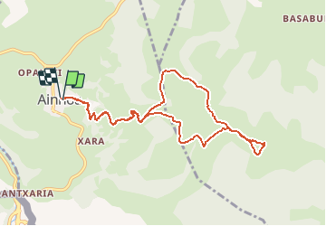
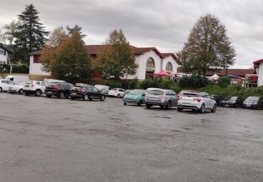
Ruta Senderismo de 10,2 km a descubrir en Nueva Aquitania, Pirineos-Atlánticos, Ainhoa. Esta ruta ha sido propuesta por tracegps.
Descripción
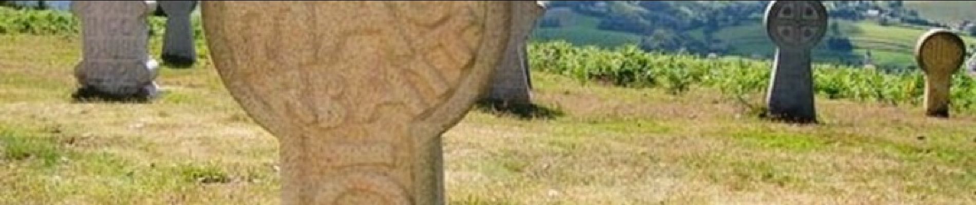
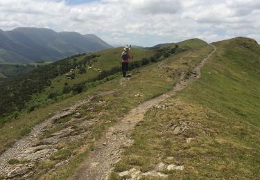
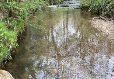
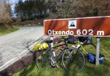
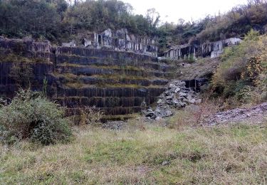
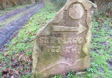
Randonnée au départ d'Ainhoa balisée par les croix de la montée au calvaire. Vue magnifique sur les montagnes du pays basque.
Localización
País:
France
Región :
Nueva Aquitania
Departamento/provincia :
Pirineos-Atlánticos
Municipio :
Ainhoa
Localidad:
Unknown
Salida:(Dec)
Salida:(UTM)
621889 ; 4795965 (30T) N.
Comentarios
Excursiones cerca
![Excursión Senderismo Espelette - Erreka mondarain col des veaux - Photo](https://media.geolcdn.com/t/375/260/ext.jpg?maxdim=2&url=https%3A%2F%2Fmedia.geolcdn.com%2Ff%2F3df7f8f7-bc92-4579-aed0-3a855d972fe6.jpg)
![Senderismo Senderismo](https://static1.geolcdn.com/sitytour/trail-icons/101.png)
Erreka mondarain col des veaux
Senderismo
Difícil
(1)
Espelette,
Nueva Aquitania,
Pirineos-Atlánticos,
France
![](/images/other/stat-length.png)
18,3 km | 29 km-effort
6h 34min
![](https://static1.geolcdn.com/siteimages/upload/files/16400158638029165_repeat_loop_refresh_sync_direction_icon.png)
Sí
![Excursión Carrera Ainhoa - Ainhoa - L'Erebi - Photo](https://media.geolcdn.com/t/375/260/ext.jpg?maxdim=2&url=https%3A%2F%2Fservices.sitytrail.com%2FGeolivesWS%2FDownloadMedia.ashx%3FTrailID%3D105338%26Media%3D9037_5.jpg)
![Carrera Carrera](https://static1.geolcdn.com/sitytour/trail-icons/103.png)
Ainhoa - L'Erebi
Carrera
Difícil
(1)
Ainhoa,
Nueva Aquitania,
Pirineos-Atlánticos,
France
![](/images/other/stat-length.png)
9,3 km | 15,9 km-effort
1h 0min
![](https://static1.geolcdn.com/siteimages/upload/files/16400158638029165_repeat_loop_refresh_sync_direction_icon.png)
Sí
![Excursión Senderismo Urdax - urdax - Photo](https://media.geolcdn.com/t/375/260/ext.jpg?maxdim=2&url=https%3A%2F%2Fmedia.geolcdn.com%2Ff%2Feb9329a6-8a81-4e34-9565-1e6fabf40cde.jpg)
![Senderismo Senderismo](https://static1.geolcdn.com/sitytour/trail-icons/101.png)
![Excursión Senderismo Espelette - De la Nive à la Nivelle - Circuit des familles - Espelette - Photo](https://media.geolcdn.com/t/375/260/ext.jpg?maxdim=2&url=https%3A%2F%2Fservices.sitytrail.com%2FGeolivesWS%2FDownloadMedia.ashx%3FTrailID%3D111304%26Media%3D6953_1.jpg)
![Senderismo Senderismo](https://static1.geolcdn.com/sitytour/trail-icons/101.png)
De la Nive à la Nivelle - Circuit des familles - Espelette
Senderismo
Fácil
(1)
Espelette,
Nueva Aquitania,
Pirineos-Atlánticos,
France
![](/images/other/stat-length.png)
7,1 km | 9,2 km-effort
1h 30min
![](https://static1.geolcdn.com/siteimages/upload/files/16400158638029165_repeat_loop_refresh_sync_direction_icon.png)
Sí
![Excursión Senderismo Espelette - ESPELETTE Le circuit des familles](https://media.geolcdn.com/t/375/260/ext.jpg?maxdim=2&url=https%3A%2F%2Fmedia.geolcdn.com%2Ff%2F9437414c-8a31-4a8c-95c7-86058d157002.jpg)
![Senderismo Senderismo](https://static1.geolcdn.com/sitytour/trail-icons/101.png)
ESPELETTE Le circuit des familles "3850002"
Senderismo
Medio
Espelette,
Nueva Aquitania,
Pirineos-Atlánticos,
France
![](/images/other/stat-length.png)
7,5 km | 9,6 km-effort
1h 55min
![](https://static1.geolcdn.com/siteimages/upload/files/16400158638029165_repeat_loop_refresh_sync_direction_icon.png)
Sí
![Excursión Senderismo Saint-Pée-sur-Nivelle - Cherchebruit pinodieta ainhoa - Photo](https://media.geolcdn.com/t/375/260/ext.jpg?maxdim=2&url=https%3A%2F%2Fmedia.geolcdn.com%2Ff%2F006a1819-4c0f-4a60-9e50-c090c0b7e023.jpg)
![Senderismo Senderismo](https://static1.geolcdn.com/sitytour/trail-icons/101.png)
Cherchebruit pinodieta ainhoa
Senderismo
Fácil
Saint-Pée-sur-Nivelle,
Nueva Aquitania,
Pirineos-Atlánticos,
France
![](/images/other/stat-length.png)
19,3 km | 27 km-effort
5h 59min
![](https://static1.geolcdn.com/siteimages/upload/files/16400158638029165_repeat_loop_refresh_sync_direction_icon.png)
Sí
![Excursión A pie Urdax - SL-NA 15 Otsondottiki - Photo](https://media.geolcdn.com/t/375/260/ext.jpg?maxdim=2&url=https%3A%2F%2Fmedia.geolcdn.com%2Ff%2F52f4bcee-e0a0-4b91-9588-fad8a39e9c22.jpeg)
![A pie A pie](https://static1.geolcdn.com/sitytour/trail-icons/100.png)
SL-NA 15 Otsondottiki
A pie
Fácil
Urdax,
Navarra,
Desconocido,
Spain
![](/images/other/stat-length.png)
8,4 km | 13,4 km-effort
3h 2min
![](https://static1.geolcdn.com/siteimages/upload/files/16400158638029165_repeat_loop_refresh_sync_direction_icon.png)
Sí
![Excursión A pie Urdax - SL-NA 17 Rincón de Axular - Photo](https://media.geolcdn.com/t/375/260/ext.jpg?maxdim=2&url=https%3A%2F%2Fmedia.geolcdn.com%2Ff%2F4ea81041-0789-4918-a312-4afe472a85c1.jpeg)
![A pie A pie](https://static1.geolcdn.com/sitytour/trail-icons/100.png)
SL-NA 17 Rincón de Axular
A pie
Fácil
Urdax,
Navarra,
Desconocido,
Spain
![](/images/other/stat-length.png)
4,9 km | 8,1 km-effort
1h 50min
![](https://static1.geolcdn.com/siteimages/upload/files/16400158638029165_repeat_loop_refresh_sync_direction_icon.png)
Sí
![Excursión Senderismo Urdax - Urdax Lizartzu circuit des bunkers - Photo](https://media.geolcdn.com/t/375/260/ext.jpg?maxdim=2&url=https%3A%2F%2Fservices.sitytrail.com%2FGeolivesWS%2FDownloadMedia.ashx%3FTrailID%3D892962%26Media%3Dc7436390-fb72-4d0d-9b84-00caadd8f947.jpg)
![Senderismo Senderismo](https://static1.geolcdn.com/sitytour/trail-icons/101.png)
Urdax Lizartzu circuit des bunkers
Senderismo
Medio
(1)
Urdax,
Navarra,
Desconocido,
Spain
![](/images/other/stat-length.png)
15,5 km | 26 km-effort
5h 22min
![](https://static1.geolcdn.com/siteimages/upload/files/16400158638029165_repeat_loop_refresh_sync_direction_icon.png)
Sí
Très bien