![](/images/other/stat-length.png)
![Excursión Paseo ecuestre Ongles - Chemins Secrets de H-P Les Granges - La Parise - Photo](https://media.geolcdn.com/t/1900/400/ext.pjpeg?maxdim=2&url=https%3A%2F%2Fstatic1.geolcdn.com%2Fsiteimages%2Fupload%2Ffiles%2F1524743154cheval.jpg)
Chemins Secrets de H-P Les Granges - La Parise
les granges
Usuario
![Longitud](/images/other/stat-length.png)
Longitud
23 km
![Altitud máxima](https://static1.geolcdn.com/siteimages/upload/files/1508320355ic_sort_altitude_max_24dp.png)
Altitud máxima
754 m
![Desnivel positivo](https://static1.geolcdn.com/siteimages/upload/files/1508320355ic_sort_den_pos_24dp.png)
Desnivel positivo
729 m
![Km-Effort](/images/other/stat-length.png)
Km-Effort
33 km
![Altitud mínima](https://static1.geolcdn.com/siteimages/upload/files/1508320355ic_sort_altitude_min_24dp.png)
Altitud mínima
449 m
![Desnivel negativo](https://static1.geolcdn.com/siteimages/upload/files/1508320355ic_sort_den_neg_24dp.png)
Desnivel negativo
694 m
![Boucle](https://static1.geolcdn.com/siteimages/upload/files/16400158638029165_repeat_loop_refresh_sync_direction_icon.png)
Boucle
No
Fecha de creación :
2020-02-11 09:43:27.157
Última modificación :
2020-02-11 09:46:03.536
![Paseo ecuestre](https://static1.geolcdn.com/sitytour/trail-icons/301.png)
4h01
Dificultad : Medio
![Escanee este código QR para abrir la excursión en la aplicación SityTrail](https://capi.geolives.com/qq0zvz2zws4bq2lad0pu/sitytour/trails/2331057/qr.png?size=200)
Aplicación GPS de excursión GRATIS
A propósito
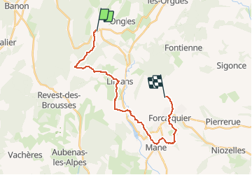
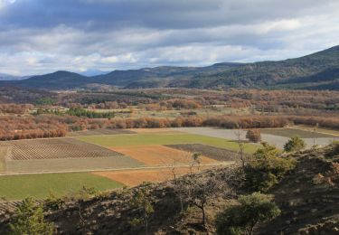
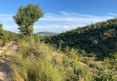
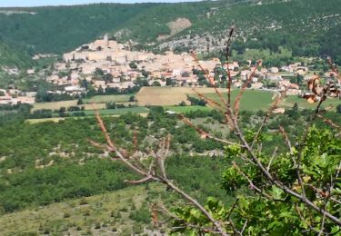
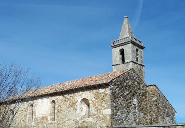
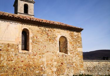
Ruta Paseo ecuestre de 23 km a descubrir en Provenza-Alpes-Costa Azul, Alpes de Alta Provenza, Ongles. Esta ruta ha sido propuesta por les granges.
Descripción
Seigne - Limans - Ybourgue - Mane - Forcalquier
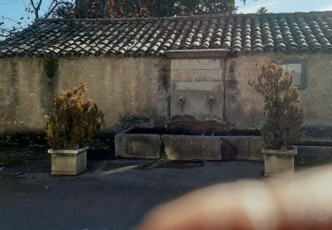
Gîte les Granges 0615224987
Localización
País:
France
Región :
Provenza-Alpes-Costa Azul
Departamento/provincia :
Alpes de Alta Provenza
Municipio :
Ongles
Localidad:
Unknown
Salida:(Dec)
Salida:(UTM)
717111 ; 4877752 (31T) N.
Comentarios
Excursiones cerca
![Excursión Senderismo Banon - Le plan du largue. la chapelle Saint Michel - Photo](https://media.geolcdn.com/t/375/260/ext.jpg?maxdim=2&url=https%3A%2F%2Fmedia.geolcdn.com%2Ff%2F3f3a59a2-e3a7-47ed-a5be-67e2d74d6232.jpg)
![Senderismo Senderismo](https://static1.geolcdn.com/sitytour/trail-icons/101.png)
Le plan du largue. la chapelle Saint Michel
Senderismo
Medio
Banon,
Provenza-Alpes-Costa Azul,
Alpes de Alta Provenza,
France
![](/images/other/stat-length.png)
15,8 km | 21 km-effort
5h 4min
![](https://static1.geolcdn.com/siteimages/upload/files/16400158638029165_repeat_loop_refresh_sync_direction_icon.png)
Sí
![Excursión Senderismo Ongles - ONGLES CASTELARD DE LARDIER7 - Photo](https://media.geolcdn.com/t/375/260/ext.jpg?maxdim=2&url=https%3A%2F%2Fmedia.geolcdn.com%2Ff%2F72624844-d345-450d-b97c-aeae78819690.jpg)
![Senderismo Senderismo](https://static1.geolcdn.com/sitytour/trail-icons/101.png)
ONGLES CASTELARD DE LARDIER7
Senderismo
Medio
Ongles,
Provenza-Alpes-Costa Azul,
Alpes de Alta Provenza,
France
![](/images/other/stat-length.png)
15,1 km | 21 km-effort
7h 10min
![](https://static1.geolcdn.com/siteimages/upload/files/16400158638029165_repeat_loop_refresh_sync_direction_icon.png)
Sí
![Excursión Senderismo Limans - Limans les pigeonniers - Photo](https://media.geolcdn.com/t/375/260/ext.jpg?maxdim=2&url=https%3A%2F%2Fmedia.geolcdn.com%2Ff%2F84dd05eb-3c85-4f48-ad46-942af416cbfb.jpg)
![Senderismo Senderismo](https://static1.geolcdn.com/sitytour/trail-icons/101.png)
Limans les pigeonniers
Senderismo
Fácil
Limans,
Provenza-Alpes-Costa Azul,
Alpes de Alta Provenza,
France
![](/images/other/stat-length.png)
8,2 km | 12,3 km-effort
5h 15min
![](https://static1.geolcdn.com/siteimages/upload/files/16400158638029165_repeat_loop_refresh_sync_direction_icon.png)
Sí
![Excursión Senderismo Limans - limans - Photo](https://media.geolcdn.com/t/375/260/ext.jpg?maxdim=2&url=https%3A%2F%2Fmedia.geolcdn.com%2Ff%2Fd1b826fa-a1f2-46bc-904f-be9163c96974.JPG)
![Senderismo Senderismo](https://static1.geolcdn.com/sitytour/trail-icons/101.png)
limans
Senderismo
Muy difícil
Limans,
Provenza-Alpes-Costa Azul,
Alpes de Alta Provenza,
France
![](/images/other/stat-length.png)
14 km | 19,1 km-effort
3h 47min
![](https://static1.geolcdn.com/siteimages/upload/files/16400158638029165_repeat_loop_refresh_sync_direction_icon.png)
Sí
![Excursión Senderismo Banon - Le Largue - Photo](https://media.geolcdn.com/t/375/260/ext.jpg?maxdim=2&url=https%3A%2F%2Fmedia.geolcdn.com%2Ff%2Fa46ecb42-31c6-4ec9-8486-2f6c92d7f7dd.jpg)
![Senderismo Senderismo](https://static1.geolcdn.com/sitytour/trail-icons/101.png)
Le Largue
Senderismo
Medio
Banon,
Provenza-Alpes-Costa Azul,
Alpes de Alta Provenza,
France
![](/images/other/stat-length.png)
8 km | 10,9 km-effort
2h 36min
![](https://static1.geolcdn.com/siteimages/upload/files/16400158638029165_repeat_loop_refresh_sync_direction_icon.png)
Sí
![Excursión Senderismo Ongles - ONGLES Sentier de Seignes Lardiers Ongles o n - Photo](https://media.geolcdn.com/t/375/260/ext.jpg?maxdim=2&url=https%3A%2F%2Fmedia.geolcdn.com%2Ff%2F797979f9-7093-4c99-a152-316a40cb322a.jpg)
![Senderismo Senderismo](https://static1.geolcdn.com/sitytour/trail-icons/101.png)
ONGLES Sentier de Seignes Lardiers Ongles o n
Senderismo
Medio
Ongles,
Provenza-Alpes-Costa Azul,
Alpes de Alta Provenza,
France
![](/images/other/stat-length.png)
17,6 km | 22 km-effort
4h 6min
![](https://static1.geolcdn.com/siteimages/upload/files/16400158638029165_repeat_loop_refresh_sync_direction_icon.png)
Sí
![Excursión Senderismo Banon - Autour du hameau du Largue - Photo](https://media.geolcdn.com/t/375/260/ext.jpg?maxdim=2&url=https%3A%2F%2Fmedia.geolcdn.com%2Ff%2Fb4031ca5-5793-40ec-9e6d-3fdef9c6df8b.jpg)
![Senderismo Senderismo](https://static1.geolcdn.com/sitytour/trail-icons/101.png)
Autour du hameau du Largue
Senderismo
Fácil
Banon,
Provenza-Alpes-Costa Azul,
Alpes de Alta Provenza,
France
![](/images/other/stat-length.png)
10,7 km | 13,7 km-effort
4h 8min
![](https://static1.geolcdn.com/siteimages/upload/files/16400158638029165_repeat_loop_refresh_sync_direction_icon.png)
Sí
![Excursión Senderismo Ongles - 200310ongles - Photo](https://media.geolcdn.com/t/375/260/ext.jpg?maxdim=2&url=https%3A%2F%2Fmedia.geolcdn.com%2Ff%2Fccea8332-fb85-48d9-95ae-b25baaaa8552.jpg)
![Senderismo Senderismo](https://static1.geolcdn.com/sitytour/trail-icons/101.png)
200310ongles
Senderismo
Muy fácil
Ongles,
Provenza-Alpes-Costa Azul,
Alpes de Alta Provenza,
France
![](/images/other/stat-length.png)
13,3 km | 17,3 km-effort
5h 39min
![](https://static1.geolcdn.com/siteimages/upload/files/16400158638029165_repeat_loop_refresh_sync_direction_icon.png)
Sí
![Excursión Senderismo Ongles - d'ongles à Lardiers - Photo](https://media.geolcdn.com/t/375/260/ext.jpg?maxdim=2&url=https%3A%2F%2Fmedia.geolcdn.com%2Ff%2F59878ada-45ef-49a7-a53f-f360581b4ce8.jpg)
![Senderismo Senderismo](https://static1.geolcdn.com/sitytour/trail-icons/101.png)
d'ongles à Lardiers
Senderismo
Fácil
Ongles,
Provenza-Alpes-Costa Azul,
Alpes de Alta Provenza,
France
![](/images/other/stat-length.png)
13,4 km | 17,4 km-effort
5h 42min
![](https://static1.geolcdn.com/siteimages/upload/files/16400158638029165_repeat_loop_refresh_sync_direction_icon.png)
Sí