Excursión Senderismo Saint-Jacques-des-Blats - le griou cantal - Photo
 mendoza
mendoza

Usuario

© OpenStreetMap contributors
Longitud
Longitud
6,3 km
Altitud máxima
Altitud máxima
1657 m
Desnivel positivo
Desnivel positivo
330 m
Km-Effort
Km-Effort  
11,2 km
Altitud mínima
Altitud mínima
1238 m
Desnivel negativo
Desnivel negativo
481 m
Boucle
Boucle
No
Fecha de creación :
2021-07-20 05:47:12.865
Última modificación :
2021-07-20 09:09:18.902

(0 Opinión)

Senderismo
Senderismo
3h21
Dificultad : Medio

Escanee este código QR para abrir la excursión en la aplicación SityTrail

Aplicación GPS de excursión GRATIS

Logo SityTrail SityTrail

IGN / Institutos geográficos

Descargar SityTrail en App Store Descargar SityTrail en Google Play

Logo SityTrail SityTrail World

El mundo es suyo

Descargar SityTrail en App Store Descargar SityTrail en Google Play Descargar SityTrail en Huawei AppGallery

A propósito

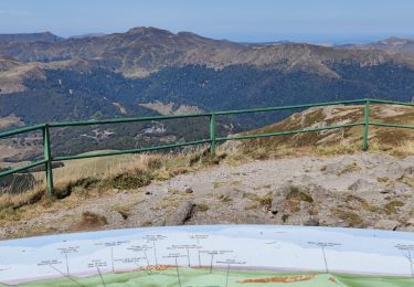
Ruta Senderismo de 6,3 km a descubrir en Auvergne-Rhône-Alpes, Cantal, Saint-Jacques-des-Blats. Esta ruta ha sido propuesta por mendoza .

Descripción

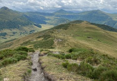
1h30 pour monter super belle rando juste les 10 derniers mètres où il faut s aider des mains mais pas complique

Perfil altimétrico

Localización

País:
France
Región :
Auvergne-Rhône-Alpes
Departamento/provincia :
Cantal
Municipio :
Saint-Jacques-des-Blats
Localidad:
Unknown
Salida:(UTM)
478505 ; 4992651 (31T) N.

Excursiones cerca

Excursión Senderismo Laveissière - Le Puy Griou de Super Lioran - Photo
Senderismo
tracegps

Senderismo

Medio
(2)
Laveissière, Auvergne-Rhône-Alpes, Cantal, France
11,9 km | 19,7 km-effort
5h 0min
Excursión Senderismo Laveissière - Le plomb du Cantal - Le Lioran - Photo
Senderismo
tracegps

Senderismo

Medio
(1)
Laveissière, Auvergne-Rhône-Alpes, Cantal, France
14,4 km | 27 km-effort
6h 0min
Excursión Senderismo Laveissière - Les crêtes du Cantal - Le Lioran - Photo
Senderismo
tracegps

Senderismo

Difícil
(4)
Laveissière, Auvergne-Rhône-Alpes, Cantal, France
28 km | 51 km-effort
7h 30min
Excursión Senderismo Laveissière - le Peyre Arse - Le Lioran - Photo
Senderismo
tracegps

Senderismo

Difícil
(1)
Laveissière, Auvergne-Rhône-Alpes, Cantal, France
11,2 km | 19,4 km-effort
4h 0min
No
Excursión Senderismo Laveissière - Lioran 2023-08-18 Col de Rombière Col du Pertus A/R - Photo
Senderismo
marionneau

Senderismo

Fácil
(1)
Laveissière, Auvergne-Rhône-Alpes, Cantal, France
12,5 km | 18,8 km-effort
4h 14min
Excursión Senderismo Laveissière - Lioran 2023-08-11 Col du Pertus - Photo
Senderismo
marionneau

Senderismo

Medio
(1)
Laveissière, Auvergne-Rhône-Alpes, Cantal, France
17,3 km | 25 km-effort
2h 57min
Excursión Senderismo Laveissière - Lioran 2023-08-09 Puy de Seycheuse - Photo
Senderismo
marionneau

Senderismo

Muy difícil
(1)
Laveissière, Auvergne-Rhône-Alpes, Cantal, France
13,9 km | 23 km-effort
5h 20min
Excursión Senderismo Laveissière - SityTrail - TABAZE Plomb du Cantal - Photo
Senderismo
PsyPezman

Senderismo

Muy difícil
Laveissière, Auvergne-Rhône-Alpes, Cantal, France
35 km | 61 km-effort
13h 53min
Excursión Senderismo Lavigerie - Puy de Niermont et plateau du Limon  - Photo
Senderismo
GUIDE
antignacs

Senderismo

Medio
Lavigerie, Auvergne-Rhône-Alpes, Cantal, France
18 km | 27 km-effort
6h 21min


Cerrar
Mis suscripciones