![](/images/other/stat-length.png)
![Excursión A pie Oostkamp - Doeveren wandelroute - Photo](https://media.geolcdn.com/t/1900/400/ext.pjpeg?maxdim=2&url=https%3A%2F%2Fmedia.geolcdn.com%2Ff%2Fc77d5902-c25a-4d2d-b762-4c4c2d8163be.jpeg)
Doeveren wandelroute
SityTrail - itinéraires balisés pédestres
Tous les sentiers balisés d’Europe PRO
![Longitud](/images/other/stat-length.png)
Longitud
5,9 km
![Altitud máxima](https://static1.geolcdn.com/siteimages/upload/files/1508320355ic_sort_altitude_max_24dp.png)
Altitud máxima
30 m
![Desnivel positivo](https://static1.geolcdn.com/siteimages/upload/files/1508320355ic_sort_den_pos_24dp.png)
Desnivel positivo
55 m
![Km-Effort](/images/other/stat-length.png)
Km-Effort
6,7 km
![Altitud mínima](https://static1.geolcdn.com/siteimages/upload/files/1508320355ic_sort_altitude_min_24dp.png)
Altitud mínima
5 m
![Desnivel negativo](https://static1.geolcdn.com/siteimages/upload/files/1508320355ic_sort_den_neg_24dp.png)
Desnivel negativo
56 m
![Boucle](https://static1.geolcdn.com/siteimages/upload/files/16400158638029165_repeat_loop_refresh_sync_direction_icon.png)
Boucle
Sí
Baliza
Fecha de creación :
2022-02-09 15:00:50.983
Última modificación :
2022-02-09 17:53:17.158
![A pie](https://static1.geolcdn.com/sitytour/trail-icons/100.png)
1h30
Dificultad : Fácil
![Escanee este código QR para abrir la excursión en la aplicación SityTrail](https://capi.geolives.com/qq0zvz2zws4bq2lad0pu/sitytour/trails/3083254/qr.png?size=200)
Aplicación GPS de excursión GRATIS
A propósito
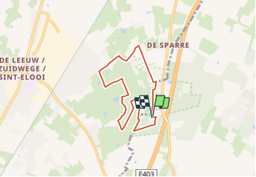
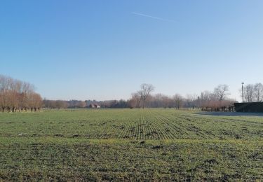
Ruta A pie de 5,9 km a descubrir en Flandes, Flandes Occidental, Oostkamp. Esta ruta ha sido propuesta por SityTrail - itinéraires balisés pédestres.
Descripción
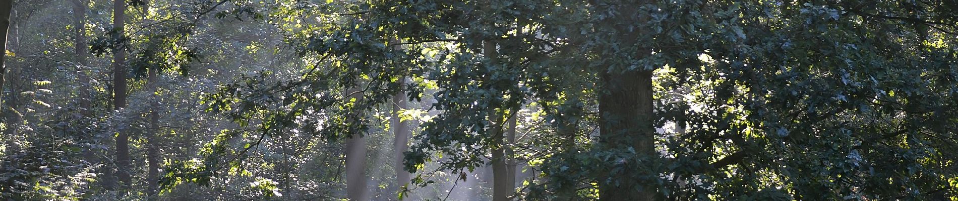
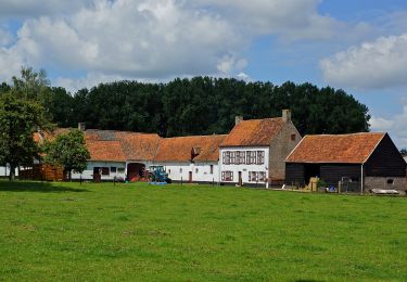
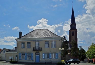
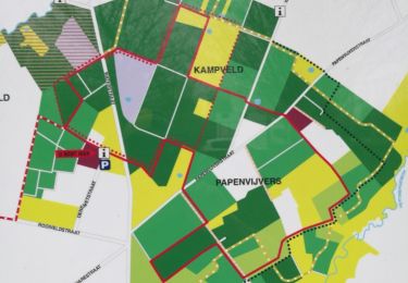
Ga op verkenning door de bos- en natuurrijke omgeving van Zedelgem en Oostkamp. De wandelroute loopt door het Merkemveldbos en Doeveren.
Localización
País:
Belgium
Región :
Flandes
Departamento/provincia :
Flandes Occidental
Municipio :
Oostkamp
Localidad:
Waardamme
Salida:(Dec)
Salida:(UTM)
513156 ; 5663470 (31U) N.
Comentarios
Excursiones cerca
![Excursión Senderismo Zedelgem - wandeltour Merkemveld 2023 - Photo](https://media.geolcdn.com/t/375/260/ext.jpg?maxdim=2&url=https%3A%2F%2Fstatic1.geolcdn.com%2Fsiteimages%2Fupload%2Ffiles%2F1553511878bg_sport_marche.png)
![Senderismo Senderismo](https://static1.geolcdn.com/sitytour/trail-icons/101.png)
wandeltour Merkemveld 2023
Senderismo
Medio
(1)
Zedelgem,
Flandes,
Flandes Occidental,
Belgium
![](/images/other/stat-length.png)
8 km | 8,9 km-effort
1h 50min
![](https://static1.geolcdn.com/siteimages/upload/files/16400158638029165_repeat_loop_refresh_sync_direction_icon.png)
No
![Excursión A pie Oostkamp - Torenhofpad - Photo](https://media.geolcdn.com/t/375/260/ext.jpg?maxdim=2&url=https%3A%2F%2Fmedia.geolcdn.com%2Ff%2F528b7473-50d0-4d67-9290-c784fca8c422.jpeg)
![A pie A pie](https://static1.geolcdn.com/sitytour/trail-icons/100.png)
Torenhofpad
A pie
Fácil
Oostkamp,
Flandes,
Flandes Occidental,
Belgium
![](/images/other/stat-length.png)
8,4 km | 9,3 km-effort
2h 6min
![](https://static1.geolcdn.com/siteimages/upload/files/16400158638029165_repeat_loop_refresh_sync_direction_icon.png)
Sí
![Excursión A pie Oostkamp - Kampveld wandelroute - Photo](https://media.geolcdn.com/t/375/260/ext.jpg?maxdim=2&url=https%3A%2F%2Fmedia.geolcdn.com%2Ff%2Fc5b0b583-6a44-4f6d-bbf8-81de4c963f27.jpeg)
![A pie A pie](https://static1.geolcdn.com/sitytour/trail-icons/100.png)
Kampveld wandelroute
A pie
Fácil
Oostkamp,
Flandes,
Flandes Occidental,
Belgium
![](/images/other/stat-length.png)
9,2 km | 10,2 km-effort
2h 18min
![](https://static1.geolcdn.com/siteimages/upload/files/16400158638029165_repeat_loop_refresh_sync_direction_icon.png)
Sí
![Excursión Senderismo Zedelgem - Rond de Kerk - Photo](https://media.geolcdn.com/t/375/260/ext.jpg?maxdim=2&url=https%3A%2F%2Fmedia.geolcdn.com%2Ff%2Fb4177b12-b44a-41e6-9815-b924d255d35e.jpg)
![Senderismo Senderismo](https://static1.geolcdn.com/sitytour/trail-icons/101.png)
Rond de Kerk
Senderismo
Muy fácil
Zedelgem,
Flandes,
Flandes Occidental,
Belgium
![](/images/other/stat-length.png)
4,8 km | 5,1 km-effort
1h 1min
![](https://static1.geolcdn.com/siteimages/upload/files/16400158638029165_repeat_loop_refresh_sync_direction_icon.png)
Sí
![Excursión Carrera Oostkamp - Waardamme - Photo](https://media.geolcdn.com/t/375/260/ext.jpg?maxdim=2&url=https%3A%2F%2Fservices.sitytrail.com%2FGeolivesWS%2FDownloadMedia.ashx%3FTrailID%3D941768%26Media%3Dfix__20180412150748.jpg)
![Carrera Carrera](https://static1.geolcdn.com/sitytour/trail-icons/103.png)
Waardamme
Carrera
Muy fácil
Oostkamp,
Flandes,
Flandes Occidental,
Belgium
![](/images/other/stat-length.png)
10,6 km | 12,1 km-effort
1h 0min
![](https://static1.geolcdn.com/siteimages/upload/files/16400158638029165_repeat_loop_refresh_sync_direction_icon.png)
Sí
![Excursión Senderismo Oostkamp - gr 131 b - Photo](https://media.geolcdn.com/t/375/260/ext.jpg?maxdim=2&url=https%3A%2F%2Fstatic1.geolcdn.com%2Fsiteimages%2Fupload%2Ffiles%2F1553511878bg_sport_marche.png)
![Senderismo Senderismo](https://static1.geolcdn.com/sitytour/trail-icons/101.png)
gr 131 b
Senderismo
Muy fácil
Oostkamp,
Flandes,
Flandes Occidental,
Belgium
![](/images/other/stat-length.png)
25 km | 27 km-effort
4h 57min
![](https://static1.geolcdn.com/siteimages/upload/files/16400158638029165_repeat_loop_refresh_sync_direction_icon.png)
No
![Excursión Senderismo Zedelgem - Via Klytepad - Photo](https://media.geolcdn.com/t/375/260/ext.jpg?maxdim=2&url=https%3A%2F%2Fstatic1.geolcdn.com%2Fsiteimages%2Fupload%2Ffiles%2F1553511878bg_sport_marche.png)
![Senderismo Senderismo](https://static1.geolcdn.com/sitytour/trail-icons/101.png)
Via Klytepad
Senderismo
Muy fácil
Zedelgem,
Flandes,
Flandes Occidental,
Belgium
![](/images/other/stat-length.png)
7,7 km | 8,2 km-effort
1h 15min
![](https://static1.geolcdn.com/siteimages/upload/files/16400158638029165_repeat_loop_refresh_sync_direction_icon.png)
Sí
![Excursión Senderismo Brujas - Zevenkerken - Photo](https://media.geolcdn.com/t/375/260/ext.jpg?maxdim=2&url=https%3A%2F%2Fstatic1.geolcdn.com%2Fsiteimages%2Fupload%2Ffiles%2F1553511878bg_sport_marche.png)
![Senderismo Senderismo](https://static1.geolcdn.com/sitytour/trail-icons/101.png)
Zevenkerken
Senderismo
Muy fácil
Brujas,
Flandes,
Flandes Occidental,
Belgium
![](/images/other/stat-length.png)
9,1 km | 10,3 km-effort
2h 5min
![](https://static1.geolcdn.com/siteimages/upload/files/16400158638029165_repeat_loop_refresh_sync_direction_icon.png)
Sí
![Excursión Bicicleta Zedelgem - f-belgie-torhout-aartrijke-veldegem - Photo](https://media.geolcdn.com/t/375/260/ext.jpg?maxdim=2&url=https%3A%2F%2Fstatic1.geolcdn.com%2Fsiteimages%2Fupload%2Ffiles%2F1524743154velo.jpg)
![Bicicleta Bicicleta](https://static1.geolcdn.com/sitytour/trail-icons/200.png)
f-belgie-torhout-aartrijke-veldegem
Bicicleta
Muy fácil
Zedelgem,
Flandes,
Flandes Occidental,
Belgium
![](/images/other/stat-length.png)
25 km | 27 km-effort
Desconocido
![](https://static1.geolcdn.com/siteimages/upload/files/16400158638029165_repeat_loop_refresh_sync_direction_icon.png)
Sí