![](/images/other/stat-length.png)
![Excursión A pie Eggolsheim - Hauptweg Eggolsheim - Photo](https://media.geolcdn.com/t/1900/400/ext.pjpeg?maxdim=2&url=https%3A%2F%2Fmedia.geolcdn.com%2Ff%2F1e2b4bf5-178c-448a-814e-cd7193781c68.jpeg)
Hauptweg Eggolsheim
SityTrail - itinéraires balisés pédestres
Tous les sentiers balisés d’Europe PRO
![Longitud](/images/other/stat-length.png)
Longitud
43 km
![Altitud máxima](https://static1.geolcdn.com/siteimages/upload/files/1508320355ic_sort_altitude_max_24dp.png)
Altitud máxima
520 m
![Desnivel positivo](https://static1.geolcdn.com/siteimages/upload/files/1508320355ic_sort_den_pos_24dp.png)
Desnivel positivo
862 m
![Km-Effort](/images/other/stat-length.png)
Km-Effort
55 km
![Altitud mínima](https://static1.geolcdn.com/siteimages/upload/files/1508320355ic_sort_altitude_min_24dp.png)
Altitud mínima
249 m
![Desnivel negativo](https://static1.geolcdn.com/siteimages/upload/files/1508320355ic_sort_den_neg_24dp.png)
Desnivel negativo
862 m
![Boucle](https://static1.geolcdn.com/siteimages/upload/files/16400158638029165_repeat_loop_refresh_sync_direction_icon.png)
Boucle
Sí
Baliza
Fecha de creación :
2022-02-11 18:24:26.576
Última modificación :
2022-02-11 18:24:26.576
![A pie](https://static1.geolcdn.com/sitytour/trail-icons/100.png)
12h28
Dificultad : Muy difícil
![Escanee este código QR para abrir la excursión en la aplicación SityTrail](https://capi.geolives.com/qq0zvz2zws4bq2lad0pu/sitytour/trails/3099388/qr.png?size=200)
Aplicación GPS de excursión GRATIS
A propósito
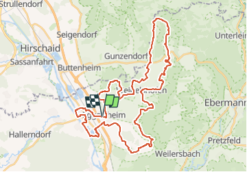
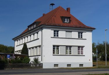
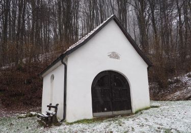
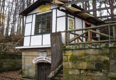
Ruta A pie de 43 km a descubrir en Baviera, Landkreis Forchheim, Eggolsheim. Esta ruta ha sido propuesta por SityTrail - itinéraires balisés pédestres.
Descripción
Trail created by Gemeinde Eggolsheim.
Wanderwegesystem der Gemeinde Eggolsheim
Symbol: Eggolsheimer Wappen (Kirche) in rotem Ring
Localización
País:
Germany
Región :
Baviera
Departamento/provincia :
Landkreis Forchheim
Municipio :
Eggolsheim
Localidad:
Unknown
Salida:(Dec)
Salida:(UTM)
647780 ; 5515177 (32U) N.
Comentarios
Excursiones cerca
![Excursión A pie Eggolsheim - Lauferlebnis Fränkische Schweiz E5 - Photo](https://media.geolcdn.com/t/375/260/ext.jpg?maxdim=2&url=https%3A%2F%2Fmedia.geolcdn.com%2Ff%2F23786ceb-0bf2-42ab-806f-dd63532c4e0f.jpeg)
![A pie A pie](https://static1.geolcdn.com/sitytour/trail-icons/100.png)
Lauferlebnis Fränkische Schweiz E5
A pie
Medio
Eggolsheim,
Baviera,
Landkreis Forchheim,
Germany
![](/images/other/stat-length.png)
21 km | 26 km-effort
5h 57min
![](https://static1.geolcdn.com/siteimages/upload/files/16400158638029165_repeat_loop_refresh_sync_direction_icon.png)
Sí
![Excursión A pie Eggolsheim - Lauferlebnis Fränkische Schweiz E4 - Photo](https://media.geolcdn.com/t/375/260/ext.jpg?maxdim=2&url=https%3A%2F%2Fmedia.geolcdn.com%2Ff%2Fbc496789-c933-459c-b5dd-3592a5fb8500.jpeg)
![A pie A pie](https://static1.geolcdn.com/sitytour/trail-icons/100.png)
Lauferlebnis Fränkische Schweiz E4
A pie
Fácil
Eggolsheim,
Baviera,
Landkreis Forchheim,
Germany
![](/images/other/stat-length.png)
10,3 km | 11,6 km-effort
2h 38min
![](https://static1.geolcdn.com/siteimages/upload/files/16400158638029165_repeat_loop_refresh_sync_direction_icon.png)
Sí
![Excursión A pie Hallerndorf - Rundweg Hallerndorf - Photo](https://media.geolcdn.com/t/375/260/ext.jpg?maxdim=2&url=https%3A%2F%2Fmedia.geolcdn.com%2Ff%2Ffb21268b-bb1a-4f10-86d6-abec2697bf4f.jpeg)
![A pie A pie](https://static1.geolcdn.com/sitytour/trail-icons/100.png)
Rundweg Hallerndorf
A pie
Fácil
Hallerndorf,
Baviera,
Landkreis Forchheim,
Germany
![](/images/other/stat-length.png)
13,3 km | 15,8 km-effort
3h 35min
![](https://static1.geolcdn.com/siteimages/upload/files/16400158638029165_repeat_loop_refresh_sync_direction_icon.png)
Sí
![Excursión A pie Eggolsheim - Lauferlebnis Fränkische Schweiz E3 - Photo](https://media.geolcdn.com/t/375/260/ext.jpg?maxdim=2&url=https%3A%2F%2Fmedia.geolcdn.com%2Ff%2Fbc496789-c933-459c-b5dd-3592a5fb8500.jpeg)
![A pie A pie](https://static1.geolcdn.com/sitytour/trail-icons/100.png)
Lauferlebnis Fränkische Schweiz E3
A pie
Fácil
Eggolsheim,
Baviera,
Landkreis Forchheim,
Germany
![](/images/other/stat-length.png)
8,5 km | 9,8 km-effort
2h 13min
![](https://static1.geolcdn.com/siteimages/upload/files/16400158638029165_repeat_loop_refresh_sync_direction_icon.png)
Sí
![Excursión A pie Eggolsheim - Lauferlebnis Fränkische Schweiz E2 - Photo](https://media.geolcdn.com/t/375/260/ext.jpg?maxdim=2&url=https%3A%2F%2Fmedia.geolcdn.com%2Ff%2Fbc496789-c933-459c-b5dd-3592a5fb8500.jpeg)
![A pie A pie](https://static1.geolcdn.com/sitytour/trail-icons/100.png)
Lauferlebnis Fränkische Schweiz E2
A pie
Fácil
Eggolsheim,
Baviera,
Landkreis Forchheim,
Germany
![](/images/other/stat-length.png)
6,1 km | 6,5 km-effort
1h 28min
![](https://static1.geolcdn.com/siteimages/upload/files/16400158638029165_repeat_loop_refresh_sync_direction_icon.png)
Sí
![Excursión A pie Eggolsheim - Lauferlebnis Fränkische Schweiz E1 - Photo](https://media.geolcdn.com/t/375/260/ext.jpg?maxdim=2&url=https%3A%2F%2Fmedia.geolcdn.com%2Ff%2Fbc496789-c933-459c-b5dd-3592a5fb8500.jpeg)
![A pie A pie](https://static1.geolcdn.com/sitytour/trail-icons/100.png)
Lauferlebnis Fränkische Schweiz E1
A pie
Fácil
Eggolsheim,
Baviera,
Landkreis Forchheim,
Germany
![](/images/other/stat-length.png)
5,2 km | 5,8 km-effort
1h 19min
![](https://static1.geolcdn.com/siteimages/upload/files/16400158638029165_repeat_loop_refresh_sync_direction_icon.png)
Sí
![Excursión A pie Hallerndorf - Neuses-Ebermannstadt - Photo](https://media.geolcdn.com/t/375/260/ext.jpg?maxdim=2&url=https%3A%2F%2Fmedia.geolcdn.com%2Ff%2Fa44d2073-ec66-4419-ba4c-c93a973431ef.jpeg)
![A pie A pie](https://static1.geolcdn.com/sitytour/trail-icons/100.png)
Neuses-Ebermannstadt
A pie
Difícil
Hallerndorf,
Baviera,
Landkreis Forchheim,
Germany
![](/images/other/stat-length.png)
26 km | 34 km-effort
7h 42min
![](https://static1.geolcdn.com/siteimages/upload/files/16400158638029165_repeat_loop_refresh_sync_direction_icon.png)
No
![Excursión A pie Forchheim - Forchheim-Rettern - Photo](https://media.geolcdn.com/t/375/260/ext.jpg?maxdim=2&url=https%3A%2F%2Fmedia.geolcdn.com%2Ff%2F40a01605-c3c6-4c7b-a777-77a3d0faa222.jpeg)
![A pie A pie](https://static1.geolcdn.com/sitytour/trail-icons/100.png)
Forchheim-Rettern
A pie
Fácil
Forchheim,
Baviera,
Landkreis Forchheim,
Germany
![](/images/other/stat-length.png)
11 km | 15,1 km-effort
3h 26min
![](https://static1.geolcdn.com/siteimages/upload/files/16400158638029165_repeat_loop_refresh_sync_direction_icon.png)
No
![Excursión A pie Forchheim - Zielwanderweg Forchheim- Reifenberg - Photo](https://media.geolcdn.com/t/375/260/ext.jpg?maxdim=2&url=https%3A%2F%2Fmedia.geolcdn.com%2Ff%2Fc0d50f5e-a0ed-4c0b-9884-db0325098052.jpeg)
![A pie A pie](https://static1.geolcdn.com/sitytour/trail-icons/100.png)
Zielwanderweg Forchheim- Reifenberg
A pie
Fácil
Forchheim,
Baviera,
Landkreis Forchheim,
Germany
![](/images/other/stat-length.png)
10,2 km | 14,4 km-effort
3h 16min
![](https://static1.geolcdn.com/siteimages/upload/files/16400158638029165_repeat_loop_refresh_sync_direction_icon.png)
No