Excursión Senderismo Athée-sur-Cher - Athée-sur-Cher - la Halbutterie - 18.6km 155m 3h50 - 2006 05 14 - Photo

Athée-sur-Cher - la Halbutterie - 18.6km 155m 3h50 - 2006 05 14

 Orcal37
Orcal37

Usuario

© OpenStreetMap contributors
Longitud
Longitud
18,6 km
Altitud máxima
Altitud máxima
102 m
Desnivel positivo
Desnivel positivo
156 m
Km-Effort
Km-Effort  
21 km
Altitud mínima
Altitud mínima
51 m
Desnivel negativo
Desnivel negativo
156 m
Boucle
Boucle
Fecha de creación :
2022-07-23 16:17:22.986
Última modificación :
2022-09-08 17:35:17.31

(0 Opinión)

Senderismo
Senderismo
3h50
Dificultad : Fácil

Escanee este código QR para abrir la excursión en la aplicación SityTrail

Aplicación GPS de excursión GRATIS

Logo SityTrail SityTrail

IGN / Institutos geográficos

Descargar SityTrail en App Store Descargar SityTrail en Google Play

Logo SityTrail SityTrail World

El mundo es suyo

Descargar SityTrail en App Store Descargar SityTrail en Google Play Descargar SityTrail en Huawei AppGallery

A propósito

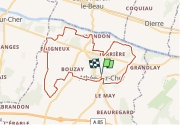
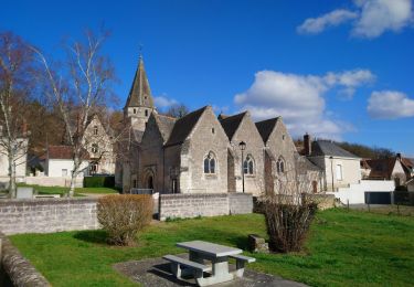
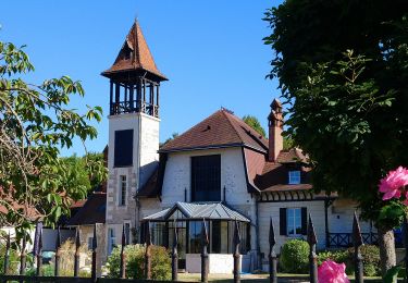
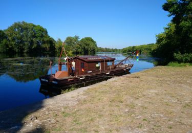
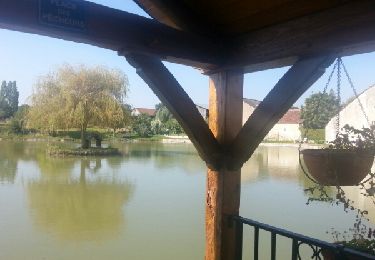
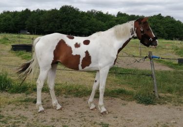
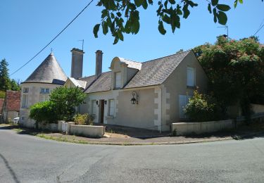
Ruta Senderismo de 18,6 km a descubrir en Centro, Indre y Loira, Athée-sur-Cher. Esta ruta ha sido propuesta por Orcal37.

Descripción

Athée-sur-Cher - la Halbutterie - 18.6km 155m 3h50 - 2006 05 14

Perfil altimétrico

Fotos

Localización

País:
France
Región :
Centro
Departamento/provincia :
Indre y Loira
Municipio :
Athée-sur-Cher
Localidad:
Unknown
Salida:(UTM)
342503 ; 5243089 (31T) N.

Excursiones cerca

Excursión Senderismo Saint-Martin-le-Beau - Saint-Martin-le-Beau - PR Entre Vignes et Forêts - 11.8km 120m 2h45 (45mn) - 2023 10 07 - Photo
Senderismo
Orcal37

Senderismo

Medio
Saint-Martin-le-Beau, Centro, Indre y Loira, France
11,8 km | 13,4 km-effort
2h 45min
Excursión Senderismo Saint-Martin-le-Beau - Saint-Martin-le-Beau - Nitray GR41 Azay-sur-Cher - 23.2km 185m 5h15 (40mn) - 2023 10 04 - Photo
Senderismo
Orcal37

Senderismo

Fácil
Saint-Martin-le-Beau, Centro, Indre y Loira, France
23 km | 26 km-effort
5h 15min
Excursión Senderismo Dierre - Dierre - St-Martin-le-Beau - 15.9km 230m 3h35 - 2023 02 26 - Photo
Senderismo
Orcal37

Senderismo

Fácil
Dierre, Centro, Indre y Loira, France
15,9 km | 19 km-effort
3h 35min
Excursión Senderismo Bléré - Bléré - Fontenay - 15.9km 145m 3h45 - 2022 07 31 - Photo
Senderismo
Orcal37

Senderismo

Fácil
Bléré, Centro, Indre y Loira, France
15,9 km | 17,8 km-effort
3h 45min
Excursión Senderismo Athée-sur-Cher - Athée-sur-Cher - Port Chandon - 18km 140m 4h05 - 2022 07 24 - Photo
Senderismo
Orcal37

Senderismo

Fácil
Athée-sur-Cher, Centro, Indre y Loira, France
18 km | 19,8 km-effort
4h 5min
Excursión Senderismo Saint-Martin-le-Beau - st martin le beau - Photo
Senderismo
fustier

Senderismo

Muy fácil
Saint-Martin-le-Beau, Centro, Indre y Loira, France
25 km | 29 km-effort
5h 54min
No
Excursión Senderismo Athée-sur-Cher - Athée sur Cher - Photo
Senderismo
danaubrac

Senderismo

Fácil
(1)
Athée-sur-Cher, Centro, Indre y Loira, France
21 km | 23 km-effort
4h 15min
Excursión Senderismo Saint-Martin-le-Beau - Touraine  - Photo
Senderismo
Patlac3

Senderismo

Medio
Saint-Martin-le-Beau, Centro, Indre y Loira, France
7,2 km | 8,2 km-effort
1h 55min
Excursión Senderismo Athée-sur-Cher - Nitray - Bléré - AR - 2015 11 15 - Photo
Senderismo
Orcal37

Senderismo

Fácil
Athée-sur-Cher, Centro, Indre y Loira, France
13,8 km | 15,5 km-effort
2h 25min


Cerrar
Mis suscripciones