


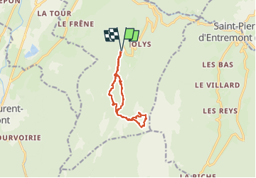

11,1 km | 17,4 km-effort

Usuario


Aplicación GPS de excursión GRATIS
 SityTrail
IGN / Institutos geográficos
SityTrail World
El mundo es suyo
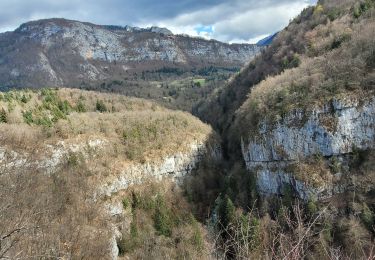
Ruta Senderismo de 11,6 km a descubrir en Auvergne-Rhône-Alpes, Isère, Saint-Christophe-sur-Guiers. Esta ruta ha sido propuesta por Emelle.
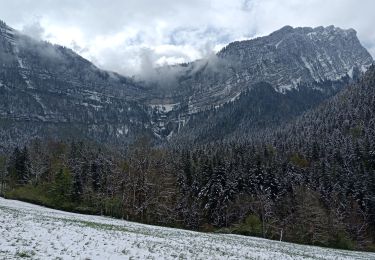
A la montée, l'accès au sommet raide (cheminée assez aisée si bonne condition) et à faire absolument par temps sec.
A la descente, le pas du Loup, goulet il fait rester vigilant si pluies les jours précédents.


Raquetas de nieve

Senderismo

Senderismo

Senderismo

Senderismo

sport
Senderismo
Senderismo
Senderismo