![](/images/other/stat-length.png)
![Excursión Senderismo Bouvières - le merlu - Photo](https://media.geolcdn.com/t/1900/400/ext.pjpeg?maxdim=2&url=https%3A%2F%2Fmedia.geolcdn.com%2Ff%2F7ba61d90-acd3-478e-807b-3a93b5e291b2.jpg)
le merlu
bymarc26
Usuario
![Longitud](/images/other/stat-length.png)
Longitud
12,3 km
![Altitud máxima](https://static1.geolcdn.com/siteimages/upload/files/1508320355ic_sort_altitude_max_24dp.png)
Altitud máxima
1600 m
![Desnivel positivo](https://static1.geolcdn.com/siteimages/upload/files/1508320355ic_sort_den_pos_24dp.png)
Desnivel positivo
870 m
![Km-Effort](/images/other/stat-length.png)
Km-Effort
24 km
![Altitud mínima](https://static1.geolcdn.com/siteimages/upload/files/1508320355ic_sort_altitude_min_24dp.png)
Altitud mínima
701 m
![Desnivel negativo](https://static1.geolcdn.com/siteimages/upload/files/1508320355ic_sort_den_neg_24dp.png)
Desnivel negativo
924 m
![Boucle](https://static1.geolcdn.com/siteimages/upload/files/16400158638029165_repeat_loop_refresh_sync_direction_icon.png)
Boucle
Sí
Fecha de creación :
2023-04-06 07:10:08.84
Última modificación :
2023-04-06 13:39:47.136
![Senderismo](https://static1.geolcdn.com/sitytour/trail-icons/101.png)
4h17
Dificultad : Medio
![Escanee este código QR para abrir la excursión en la aplicación SityTrail](https://capi.geolives.com/qq0zvz2zws4bq2lad0pu/sitytour/trails/3611210/qr.png?size=200)
Aplicación GPS de excursión GRATIS
A propósito
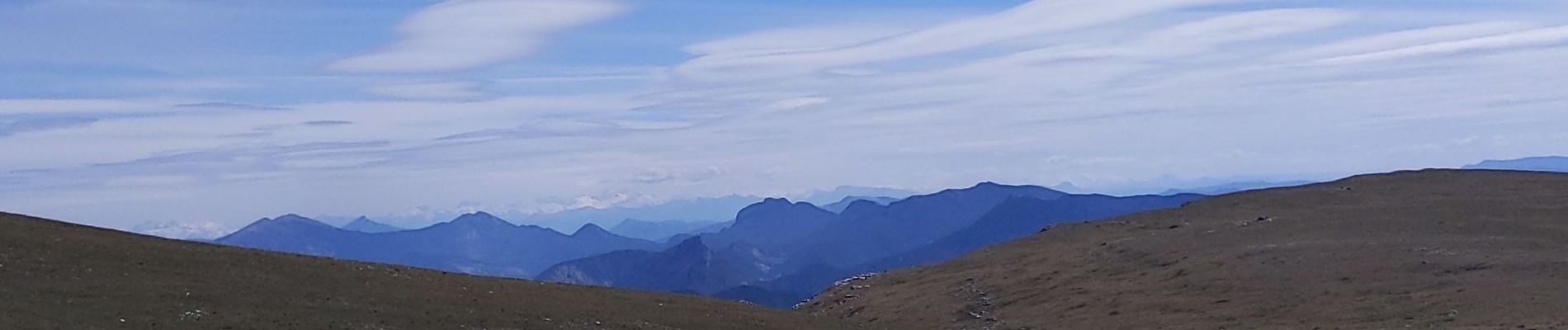
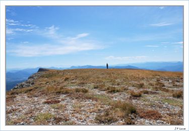
Ruta Senderismo de 12,3 km a descubrir en Auvergne-Rhône-Alpes, Drôme, Bouvières. Esta ruta ha sido propuesta por bymarc26.
Descripción
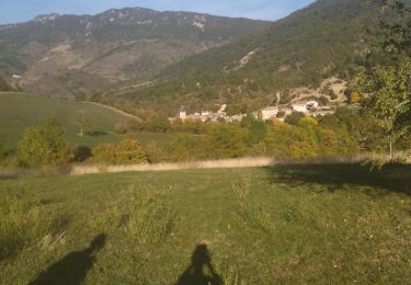
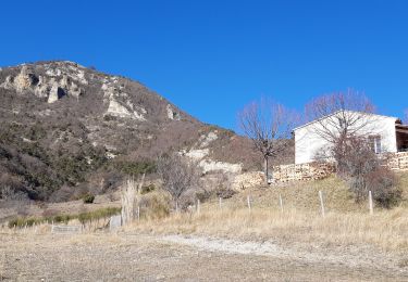
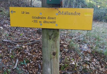
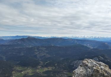
fait le 6 avril avant que les moutons ne montent.
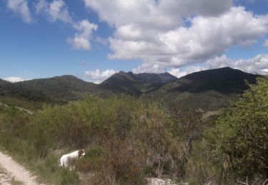
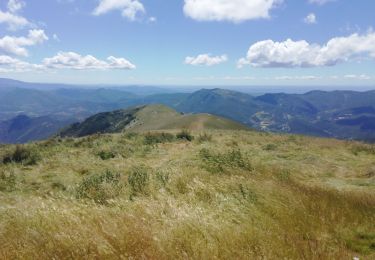
Rester sur le Merlu sans parcourir la Montagne d'Angèle
Localización
País:
France
Región :
Auvergne-Rhône-Alpes
Departamento/provincia :
Drôme
Municipio :
Bouvières
Localidad:
Unknown
Salida:(Dec)
Salida:(UTM)
678734 ; 4930587 (31T) N.
Comentarios
Excursiones cerca
![Excursión Senderismo Villeperdrix - Montagne d'Angèle - Photo](https://media.geolcdn.com/t/375/260/ext.jpg?maxdim=2&url=https%3A%2F%2Fservices.sitytrail.com%2FGeolivesWS%2FDownloadMedia.ashx%3FTrailID%3D104539%26Media%3D7884_4.jpg)
![Senderismo Senderismo](https://static1.geolcdn.com/sitytour/trail-icons/101.png)
Montagne d'Angèle
Senderismo
Difícil
(1)
Villeperdrix,
Auvergne-Rhône-Alpes,
Drôme,
France
![](/images/other/stat-length.png)
8,6 km | 18,1 km-effort
3h 30min
![](https://static1.geolcdn.com/siteimages/upload/files/16400158638029165_repeat_loop_refresh_sync_direction_icon.png)
No
![Excursión Senderismo Gumiane - Angèle - Photo](https://media.geolcdn.com/t/375/260/ext.jpg?maxdim=2&url=https%3A%2F%2Fmedia.geolcdn.com%2Ff%2F4a109e75-c91a-41b5-b20f-b684de899b3e.jpg)
![Senderismo Senderismo](https://static1.geolcdn.com/sitytour/trail-icons/101.png)
Angèle
Senderismo
Muy difícil
Gumiane,
Auvergne-Rhône-Alpes,
Drôme,
France
![](/images/other/stat-length.png)
10,3 km | 21 km-effort
4h 50min
![](https://static1.geolcdn.com/siteimages/upload/files/16400158638029165_repeat_loop_refresh_sync_direction_icon.png)
Sí
![Excursión Senderismo Bouvières - 26 mielandre 09.2023 - Photo](https://media.geolcdn.com/t/375/260/ext.jpg?maxdim=2&url=https%3A%2F%2Fmedia.geolcdn.com%2Ff%2F5b567aa0-d7b4-48f7-ae8b-e3567a1c2c82.jpg)
![Senderismo Senderismo](https://static1.geolcdn.com/sitytour/trail-icons/101.png)
26 mielandre 09.2023
Senderismo
Medio
Bouvières,
Auvergne-Rhône-Alpes,
Drôme,
France
![](/images/other/stat-length.png)
16 km | 31 km-effort
7h 37min
![](https://static1.geolcdn.com/siteimages/upload/files/16400158638029165_repeat_loop_refresh_sync_direction_icon.png)
No
![Excursión Senderismo Valouse - mielandre - Photo](https://media.geolcdn.com/t/375/260/ext.jpg?maxdim=2&url=https%3A%2F%2Fmedia.geolcdn.com%2Ff%2Ff5718be0-7b70-47ac-8b04-32aa7a492791.jpg)
![Senderismo Senderismo](https://static1.geolcdn.com/sitytour/trail-icons/101.png)
mielandre
Senderismo
Muy difícil
Valouse,
Auvergne-Rhône-Alpes,
Drôme,
France
![](/images/other/stat-length.png)
11,3 km | 23 km-effort
6h 34min
![](https://static1.geolcdn.com/siteimages/upload/files/16400158638029165_repeat_loop_refresh_sync_direction_icon.png)
Sí
![Excursión Senderismo Gumiane - le Merlu - Photo](https://media.geolcdn.com/t/375/260/ext.jpg?maxdim=2&url=https%3A%2F%2Fmedia.geolcdn.com%2Ff%2F519ae12a-4541-459c-99dd-41c709c1a9c7.jpg)
![Senderismo Senderismo](https://static1.geolcdn.com/sitytour/trail-icons/101.png)
le Merlu
Senderismo
Medio
Gumiane,
Auvergne-Rhône-Alpes,
Drôme,
France
![](/images/other/stat-length.png)
11,6 km | 25 km-effort
4h 13min
![](https://static1.geolcdn.com/siteimages/upload/files/16400158638029165_repeat_loop_refresh_sync_direction_icon.png)
Sí
![Excursión Senderismo Vesc - Mielandre par col d'Espreaux 7km - Photo](https://media.geolcdn.com/t/375/260/ext.jpg?maxdim=2&url=https%3A%2F%2Fmedia.geolcdn.com%2Ff%2Fd636efce-2d2e-4f2f-885e-11899dc3cecf.jpg)
![Senderismo Senderismo](https://static1.geolcdn.com/sitytour/trail-icons/101.png)
Mielandre par col d'Espreaux 7km
Senderismo
Difícil
Vesc,
Auvergne-Rhône-Alpes,
Drôme,
France
![](/images/other/stat-length.png)
7,1 km | 15,7 km-effort
5h 3min
![](https://static1.geolcdn.com/siteimages/upload/files/16400158638029165_repeat_loop_refresh_sync_direction_icon.png)
Sí
![Excursión Senderismo Chaudebonne - la serre de créma - Photo](https://media.geolcdn.com/t/375/260/ext.jpg?maxdim=2&url=https%3A%2F%2Fmedia.geolcdn.com%2Ff%2Fc1f4414d-5881-4e6a-9769-3a88a282ace5.jpg)
![Senderismo Senderismo](https://static1.geolcdn.com/sitytour/trail-icons/101.png)
la serre de créma
Senderismo
Difícil
Chaudebonne,
Auvergne-Rhône-Alpes,
Drôme,
France
![](/images/other/stat-length.png)
10 km | 19,8 km-effort
4h 44min
![](https://static1.geolcdn.com/siteimages/upload/files/16400158638029165_repeat_loop_refresh_sync_direction_icon.png)
Sí
![Excursión Senderismo Bouvières - Mielandre - Photo](https://media.geolcdn.com/t/375/260/ext.jpg?maxdim=2&url=https%3A%2F%2Fmedia.geolcdn.com%2Ff%2F871654f3-1375-4094-b447-b3b8c9304919.jpg)
![Senderismo Senderismo](https://static1.geolcdn.com/sitytour/trail-icons/101.png)
Mielandre
Senderismo
Difícil
Bouvières,
Auvergne-Rhône-Alpes,
Drôme,
France
![](/images/other/stat-length.png)
16,1 km | 32 km-effort
7h 37min
![](https://static1.geolcdn.com/siteimages/upload/files/16400158638029165_repeat_loop_refresh_sync_direction_icon.png)
Sí
![Excursión Senderismo Gumiane - le merlu, Montagne d'Angèle depuis col de lescou - Photo](https://media.geolcdn.com/t/375/260/ext.jpg?maxdim=2&url=https%3A%2F%2Fmedia.geolcdn.com%2Ff%2F060c11fa-484b-49bf-8bbc-22971b83dc3e.jpg)
![Senderismo Senderismo](https://static1.geolcdn.com/sitytour/trail-icons/101.png)
le merlu, Montagne d'Angèle depuis col de lescou
Senderismo
Difícil
Gumiane,
Auvergne-Rhône-Alpes,
Drôme,
France
![](/images/other/stat-length.png)
12,6 km | 25 km-effort
4h 10min
![](https://static1.geolcdn.com/siteimages/upload/files/16400158638029165_repeat_loop_refresh_sync_direction_icon.png)
Sí