![](/images/other/stat-length.png)
![Excursión Senderismo Blankenberge - BLANKENBERGE _ Tweedaagse van Vlaanderen _ Circuit 2_ 7/05/2023 - Photo](https://media.geolcdn.com/t/1900/400/ext.pjpeg?maxdim=2&url=https%3A%2F%2Fstatic1.geolcdn.com%2Fsiteimages%2Fupload%2Ffiles%2F1553511878bg_sport_marche.png)
BLANKENBERGE _ Tweedaagse van Vlaanderen _ Circuit 2_ 7/05/2023
jeangulu
Usuario
![Longitud](/images/other/stat-length.png)
Longitud
24 km
![Altitud máxima](https://static1.geolcdn.com/siteimages/upload/files/1508320355ic_sort_altitude_max_24dp.png)
Altitud máxima
20 m
![Desnivel positivo](https://static1.geolcdn.com/siteimages/upload/files/1508320355ic_sort_den_pos_24dp.png)
Desnivel positivo
103 m
![Km-Effort](/images/other/stat-length.png)
Km-Effort
25 km
![Altitud mínima](https://static1.geolcdn.com/siteimages/upload/files/1508320355ic_sort_altitude_min_24dp.png)
Altitud mínima
-2 m
![Desnivel negativo](https://static1.geolcdn.com/siteimages/upload/files/1508320355ic_sort_den_neg_24dp.png)
Desnivel negativo
107 m
![Boucle](https://static1.geolcdn.com/siteimages/upload/files/16400158638029165_repeat_loop_refresh_sync_direction_icon.png)
Boucle
Sí
Fecha de creación :
2023-05-07 06:29:20.198
Última modificación :
2023-05-10 08:44:35.266
![Senderismo](https://static1.geolcdn.com/sitytour/trail-icons/101.png)
6h08
Dificultad : Medio
![Escanee este código QR para abrir la excursión en la aplicación SityTrail](https://capi.geolives.com/qq0zvz2zws4bq2lad0pu/sitytour/trails/3650211/qr.png?size=200)
Aplicación GPS de excursión GRATIS
A propósito
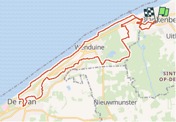
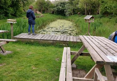
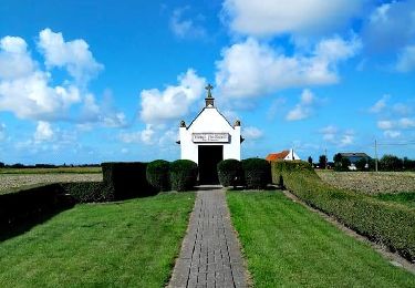
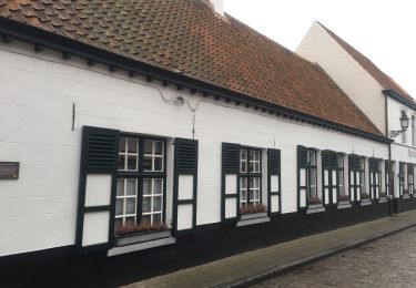
Ruta Senderismo de 24 km a descubrir en Flandes, Flandes Occidental, Blankenberge. Esta ruta ha sido propuesta por jeangulu.
Descripción
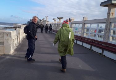
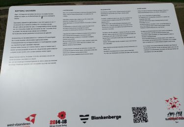
TWEEDAAGSE VOETTOCHT BLANKENBERGE.
Participants : Simon Hinq _ Nadyne Carraro _ Jean Claude Delcourt.
Le lieu de départ et d’arrivée se situe à l’Athénée de Maerlant, à proximité de la gare et de l’arrêt de tramway. (carte)
Localización
País:
Belgium
Región :
Flandes
Departamento/provincia :
Flandes Occidental
Municipio :
Blankenberge
Localidad:
Blankenberge
Salida:(Dec)
Salida:(UTM)
508837 ; 5684282 (31U) N.
Comentarios
Excursiones cerca
![Excursión A pie Blankenberge - Erfgoedwandelroute Blankenberge - Photo](https://media.geolcdn.com/t/375/260/ext.jpg?maxdim=2&url=https%3A%2F%2Fmedia.geolcdn.com%2Ff%2F89899cee-80b3-4c52-972f-0300408f72cc.jpeg)
![A pie A pie](https://static1.geolcdn.com/sitytour/trail-icons/100.png)
Erfgoedwandelroute Blankenberge
A pie
Fácil
Blankenberge,
Flandes,
Flandes Occidental,
Belgium
![](/images/other/stat-length.png)
3,7 km | 4,3 km-effort
58min
![](https://static1.geolcdn.com/siteimages/upload/files/16400158638029165_repeat_loop_refresh_sync_direction_icon.png)
Sí
![Excursión A pie Brujas - Ter Doest wandelroute - Photo](https://media.geolcdn.com/t/375/260/ext.jpg?maxdim=2&url=https%3A%2F%2Fmedia.geolcdn.com%2Ff%2F7c264992-b54a-400b-9ef1-c9a11c4d9d34.jpeg)
![A pie A pie](https://static1.geolcdn.com/sitytour/trail-icons/100.png)
Ter Doest wandelroute
A pie
Fácil
(2)
Brujas,
Flandes,
Flandes Occidental,
Belgium
![](/images/other/stat-length.png)
4,2 km | 4,5 km-effort
1h 1min
![](https://static1.geolcdn.com/siteimages/upload/files/16400158638029165_repeat_loop_refresh_sync_direction_icon.png)
Sí
![Excursión Senderismo Blankenberge - Blankenberge 11 km - Photo](https://media.geolcdn.com/t/375/260/ext.jpg?maxdim=2&url=https%3A%2F%2Fmedia.geolcdn.com%2Ff%2F84b86324-52f7-48d6-953a-de3aacb09f38.jpg)
![Senderismo Senderismo](https://static1.geolcdn.com/sitytour/trail-icons/101.png)
Blankenberge 11 km
Senderismo
Medio
Blankenberge,
Flandes,
Flandes Occidental,
Belgium
![](/images/other/stat-length.png)
11,6 km | 12,5 km-effort
2h 47min
![](https://static1.geolcdn.com/siteimages/upload/files/16400158638029165_repeat_loop_refresh_sync_direction_icon.png)
Sí
![Excursión Senderismo Blankenberge - BLANKENBERGE _ Marche international le Tweedaagse _ Blankenberge VZW - 1/05/2022 - Photo](https://media.geolcdn.com/t/375/260/ext.jpg?maxdim=2&url=https%3A%2F%2Fmedia.geolcdn.com%2Ff%2Ff0b619f8-3743-47b7-bc81-acd9ac4c9caf.jpg)
![Senderismo Senderismo](https://static1.geolcdn.com/sitytour/trail-icons/101.png)
BLANKENBERGE _ Marche international le Tweedaagse _ Blankenberge VZW - 1/05/2022
Senderismo
Muy difícil
(1)
Blankenberge,
Flandes,
Flandes Occidental,
Belgium
![](/images/other/stat-length.png)
18,3 km | 19,1 km-effort
5h 48min
![](https://static1.geolcdn.com/siteimages/upload/files/16400158638029165_repeat_loop_refresh_sync_direction_icon.png)
Sí
![Excursión Senderismo Blankenberge - Promenade dans les Polders - Photo](https://media.geolcdn.com/t/375/260/ext.jpg?maxdim=2&url=https%3A%2F%2Fmedia.geolcdn.com%2Ff%2Ff03ed4f1-113c-4cac-8d3c-46dc6eb4a2ad.jpg)
![Senderismo Senderismo](https://static1.geolcdn.com/sitytour/trail-icons/101.png)
Promenade dans les Polders
Senderismo
Medio
Blankenberge,
Flandes,
Flandes Occidental,
Belgium
![](/images/other/stat-length.png)
7,7 km | 8 km-effort
1h 48min
![](https://static1.geolcdn.com/siteimages/upload/files/16400158638029165_repeat_loop_refresh_sync_direction_icon.png)
Sí
![Excursión Senderismo Blankenberge - Blankenberge _ Tweedaagse van Vlaanderen - Photo](https://media.geolcdn.com/t/375/260/ext.jpg?maxdim=2&url=https%3A%2F%2Fmedia.geolcdn.com%2Ff%2F12565188-5eaa-4bf9-b4b4-f92a7e5b3601.jpg)
![Senderismo Senderismo](https://static1.geolcdn.com/sitytour/trail-icons/101.png)
Blankenberge _ Tweedaagse van Vlaanderen
Senderismo
Medio
Blankenberge,
Flandes,
Flandes Occidental,
Belgium
![](/images/other/stat-length.png)
26 km | 28 km-effort
6h 34min
![](https://static1.geolcdn.com/siteimages/upload/files/16400158638029165_repeat_loop_refresh_sync_direction_icon.png)
Sí
![Excursión Carrera De Haan - Footing De Haan - Photo](https://media.geolcdn.com/t/375/260/ext.jpg?maxdim=2&url=https%3A%2F%2Fstatic1.geolcdn.com%2Fsiteimages%2Fupload%2Ffiles%2F1524743154running.jpg)
![Carrera Carrera](https://static1.geolcdn.com/sitytour/trail-icons/103.png)
Footing De Haan
Carrera
Fácil
(1)
De Haan,
Flandes,
Flandes Occidental,
Belgium
![](/images/other/stat-length.png)
4,7 km | 5,1 km-effort
43min
![](https://static1.geolcdn.com/siteimages/upload/files/16400158638029165_repeat_loop_refresh_sync_direction_icon.png)
Sí
![Excursión Senderismo Blankenberge - Blankenberge _ Circuit 2 _ Tweedaagse van Vlanderen - Photo](https://media.geolcdn.com/t/375/260/ext.jpg?maxdim=2&url=https%3A%2F%2Fmedia.geolcdn.com%2Ff%2F6accc6cd-3e83-43ed-9593-7ba7873a1a5c.jpg)
![Senderismo Senderismo](https://static1.geolcdn.com/sitytour/trail-icons/101.png)
Blankenberge _ Circuit 2 _ Tweedaagse van Vlanderen
Senderismo
Fácil
Blankenberge,
Flandes,
Flandes Occidental,
Belgium
![](/images/other/stat-length.png)
25 km | 26 km-effort
6h 52min
![](https://static1.geolcdn.com/siteimages/upload/files/16400158638029165_repeat_loop_refresh_sync_direction_icon.png)
Sí
![Excursión Senderismo Blankenberge - 30.323 Blankenberge - Lissewege - Photo](https://media.geolcdn.com/t/375/260/ext.jpg?maxdim=2&url=https%3A%2F%2Fmedia.geolcdn.com%2Ff%2Fe8af1102-34bd-4cf8-94bc-3594e75c7e13.jpg)
![Senderismo Senderismo](https://static1.geolcdn.com/sitytour/trail-icons/101.png)
30.323 Blankenberge - Lissewege
Senderismo
Muy fácil
(1)
Blankenberge,
Flandes,
Flandes Occidental,
Belgium
![](/images/other/stat-length.png)
8,1 km | 8,5 km-effort
1h 50min
![](https://static1.geolcdn.com/siteimages/upload/files/16400158638029165_repeat_loop_refresh_sync_direction_icon.png)
No