![](/images/other/stat-length.png)
![Excursión Senderismo Croisy-sur-Andelle - Croisy-sur-Andelle - La vallée de l''Andelle - Photo](https://media.geolcdn.com/t/1900/400/ext.pjpeg?maxdim=2&url=https%3A%2F%2Fstatic1.geolcdn.com%2Fsiteimages%2Fupload%2Ffiles%2F1553511878bg_sport_marche.png)
Croisy-sur-Andelle - La vallée de l''Andelle
Heliot76
Usuario
![Longitud](/images/other/stat-length.png)
Longitud
12,5 km
![Altitud máxima](https://static1.geolcdn.com/siteimages/upload/files/1508320355ic_sort_altitude_max_24dp.png)
Altitud máxima
178 m
![Desnivel positivo](https://static1.geolcdn.com/siteimages/upload/files/1508320355ic_sort_den_pos_24dp.png)
Desnivel positivo
284 m
![Km-Effort](/images/other/stat-length.png)
Km-Effort
16,3 km
![Altitud mínima](https://static1.geolcdn.com/siteimages/upload/files/1508320355ic_sort_altitude_min_24dp.png)
Altitud mínima
59 m
![Desnivel negativo](https://static1.geolcdn.com/siteimages/upload/files/1508320355ic_sort_den_neg_24dp.png)
Desnivel negativo
282 m
![Boucle](https://static1.geolcdn.com/siteimages/upload/files/16400158638029165_repeat_loop_refresh_sync_direction_icon.png)
Boucle
Sí
Fecha de creación :
2018-04-17 14:25:20.855
Última modificación :
2018-04-17 14:25:20.855
![Senderismo](https://static1.geolcdn.com/sitytour/trail-icons/101.png)
3h31
Dificultad : Medio
![Escanee este código QR para abrir la excursión en la aplicación SityTrail](https://capi.geolives.com/qq0zvz2zws4bq2lad0pu/sitytour/trails/873886/qr.png?size=200)
Aplicación GPS de excursión GRATIS
A propósito
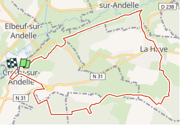
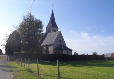
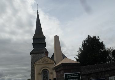
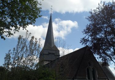
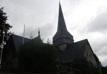
Ruta Senderismo de 12,5 km a descubrir en Normandía, Sena-Marítimo, Croisy-sur-Andelle. Esta ruta ha sido propuesta por Heliot76.
Descripción
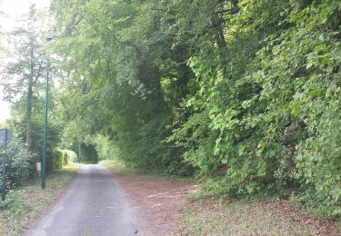
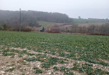
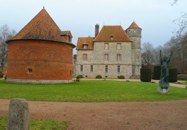
rando vallée de l''Andelle forêt de Lyons
Départ parking de la mairie de Croisy-sur-Andelle
Localización
País:
France
Región :
Normandía
Departamento/provincia :
Sena-Marítimo
Municipio :
Croisy-sur-Andelle
Localidad:
Unknown
Salida:(Dec)
Salida:(UTM)
383704 ; 5479894 (31U) N.
Comentarios
Excursiones cerca
![Excursión Senderismo Ry - 20180717 Ry - Photo](https://media.geolcdn.com/t/375/260/ext.jpg?maxdim=2&url=https%3A%2F%2Fmedia.geolcdn.com%2Ff%2Fb30395c9-0797-4cee-b9f6-edfda2e59801.jpg)
![Senderismo Senderismo](https://static1.geolcdn.com/sitytour/trail-icons/101.png)
20180717 Ry
Senderismo
Medio
(1)
Ry,
Normandía,
Sena-Marítimo,
France
![](/images/other/stat-length.png)
12,3 km | 0 m-effort
3h 22min
![](https://static1.geolcdn.com/siteimages/upload/files/16400158638029165_repeat_loop_refresh_sync_direction_icon.png)
Sí
![Excursión Senderismo Le Héron - Rebets par l'Héronchelles - Photo](https://media.geolcdn.com/t/375/260/ext.jpg?maxdim=2&url=https%3A%2F%2Fmedia.geolcdn.com%2Ff%2Fd3f3818d-0528-4506-9a5b-801bed775619.jpg)
![Senderismo Senderismo](https://static1.geolcdn.com/sitytour/trail-icons/101.png)
Rebets par l'Héronchelles
Senderismo
Difícil
Le Héron,
Normandía,
Sena-Marítimo,
France
![](/images/other/stat-length.png)
11,2 km | 15,2 km-effort
3h 7min
![](https://static1.geolcdn.com/siteimages/upload/files/16400158638029165_repeat_loop_refresh_sync_direction_icon.png)
Sí
![Excursión Senderismo Vascœuil - 20231207-Vascoeuil - Photo](https://media.geolcdn.com/t/375/260/ext.jpg?maxdim=2&url=https%3A%2F%2Fmedia.geolcdn.com%2Ff%2F28309a96-08a4-43f2-a0b8-39574349c8d0.JPG)
![Senderismo Senderismo](https://static1.geolcdn.com/sitytour/trail-icons/101.png)
20231207-Vascoeuil
Senderismo
Medio
Vascœuil,
Normandía,
Eure,
France
![](/images/other/stat-length.png)
10,9 km | 14,1 km-effort
3h 6min
![](https://static1.geolcdn.com/siteimages/upload/files/16400158638029165_repeat_loop_refresh_sync_direction_icon.png)
Sí
![Excursión Senderismo Saint-Aignan-sur-Ry - 20230926-St Aignan sur Ry - Photo](https://media.geolcdn.com/t/375/260/ext.jpg?maxdim=2&url=https%3A%2F%2Fmedia.geolcdn.com%2Ff%2F02be2deb-3e4f-4be7-81c7-4422bf52073d.JPG)
![Senderismo Senderismo](https://static1.geolcdn.com/sitytour/trail-icons/101.png)
20230926-St Aignan sur Ry
Senderismo
Medio
Saint-Aignan-sur-Ry,
Normandía,
Sena-Marítimo,
France
![](/images/other/stat-length.png)
11,8 km | 15,6 km-effort
3h 23min
![](https://static1.geolcdn.com/siteimages/upload/files/16400158638029165_repeat_loop_refresh_sync_direction_icon.png)
Sí
![Excursión Senderismo Elbeuf-sur-Andelle - 20220823-Elbeuf sur Andelle - Photo](https://media.geolcdn.com/t/375/260/ext.jpg?maxdim=2&url=https%3A%2F%2Fmedia.geolcdn.com%2Ff%2Fb1c6320e-0920-405d-91ad-83cfd83dc1a4.JPG)
![Senderismo Senderismo](https://static1.geolcdn.com/sitytour/trail-icons/101.png)
20220823-Elbeuf sur Andelle
Senderismo
Medio
Elbeuf-sur-Andelle,
Normandía,
Sena-Marítimo,
France
![](/images/other/stat-length.png)
12,6 km | 15,9 km-effort
3h 23min
![](https://static1.geolcdn.com/siteimages/upload/files/16400158638029165_repeat_loop_refresh_sync_direction_icon.png)
Sí
![Excursión Senderismo Ry - 20220426-Ry - Photo](https://media.geolcdn.com/t/375/260/ext.jpg?maxdim=2&url=https%3A%2F%2Fmedia.geolcdn.com%2Ff%2F23fa6392-73be-41fa-9993-e3f9db068f8f.JPG)
![Senderismo Senderismo](https://static1.geolcdn.com/sitytour/trail-icons/101.png)
20220426-Ry
Senderismo
Medio
Ry,
Normandía,
Sena-Marítimo,
France
![](/images/other/stat-length.png)
11,7 km | 14,6 km-effort
3h 8min
![](https://static1.geolcdn.com/siteimages/upload/files/16400158638029165_repeat_loop_refresh_sync_direction_icon.png)
Sí
![Excursión Senderismo Ry - 20201006-Ry - Photo](https://media.geolcdn.com/t/375/260/ext.jpg?maxdim=2&url=https%3A%2F%2Fmedia.geolcdn.com%2Ff%2F6059f0bd-0735-42d2-b4b7-425165fd7365.JPG)
![Senderismo Senderismo](https://static1.geolcdn.com/sitytour/trail-icons/101.png)
20201006-Ry
Senderismo
Medio
Ry,
Normandía,
Sena-Marítimo,
France
![](/images/other/stat-length.png)
10,4 km | 12,4 km-effort
2h 45min
![](https://static1.geolcdn.com/siteimages/upload/files/16400158638029165_repeat_loop_refresh_sync_direction_icon.png)
Sí
![Excursión Senderismo Vascœuil - 20200804-Vascoeuil - Photo](https://media.geolcdn.com/t/375/260/ext.jpg?maxdim=2&url=https%3A%2F%2Fmedia.geolcdn.com%2Ff%2F03fc3f4c-afab-418b-a795-973853373728.JPG)
![Senderismo Senderismo](https://static1.geolcdn.com/sitytour/trail-icons/101.png)
20200804-Vascoeuil
Senderismo
Medio
Vascœuil,
Normandía,
Eure,
France
![](/images/other/stat-length.png)
13,9 km | 17,7 km-effort
3h 47min
![](https://static1.geolcdn.com/siteimages/upload/files/16400158638029165_repeat_loop_refresh_sync_direction_icon.png)
Sí
![Excursión Senderismo Elbeuf-sur-Andelle - 20191022-Le Héron-Elbeuf sur Andelle - Photo](https://media.geolcdn.com/t/375/260/ext.jpg?maxdim=2&url=https%3A%2F%2Fmedia.geolcdn.com%2Ff%2F840f6012-be0d-4e41-b241-d787cc32f4f4.JPG)
![Senderismo Senderismo](https://static1.geolcdn.com/sitytour/trail-icons/101.png)
20191022-Le Héron-Elbeuf sur Andelle
Senderismo
Medio
Elbeuf-sur-Andelle,
Normandía,
Sena-Marítimo,
France
![](/images/other/stat-length.png)
11,9 km | 15,1 km-effort
3h 13min
![](https://static1.geolcdn.com/siteimages/upload/files/16400158638029165_repeat_loop_refresh_sync_direction_icon.png)
Sí