


8,5 km | 10,6 km-effort
Gerpinnes : découvrez les meilleures randonnées : 6 a pied, 332 marche, 12 marche nordique et 157 course à pied. Tous ces circuits, parcours, itinéraires et activités en plein air sont disponibles dans nos applications SityTrail pour smartphones et tablettes.

Marche


• Details de la rando sur TraceGPS.com http://www.tracegps.com/fr/parcours/circuit3354.htm
Marche
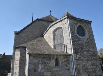
• Gerpinnes est un des hauts lieux des Marches de l’Entre-Sambre-et-Meuse. La châsse de sainte Rolende est portée en pr...

Marche
• Gerpinnes est un des hauts lieux des Marches de l’Entre-Sambre-et-Meuse. La châsse de sainte Rolende est portée en pr...
Marche
• Parcours entièrement dans les bois. Tournibus, Noir Bois, Bois de la Gatte, Bois des Rivers, Bois d'Hanzinne. Le parc...
Marche
• Parcours entièrement dans les bois. Tournibus, Noir Bois, Bois de la Gatte, Bois des Rivers, Bois d'Hanzinne. Le parc...

Marche
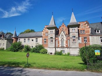
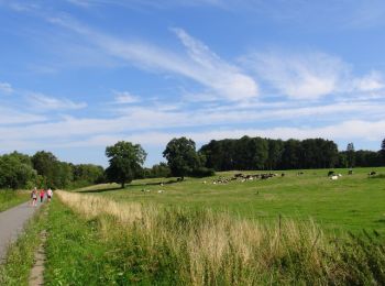
• Parcours campagnard avec détours dans Gougnies. Passage auprès du château d’Eric Emmanuel Schmidt
Marche
• Descendre la RN 574 sur 200 m. Prendre à gauche. Les chemins parcourent la campagne et la forêt sur le reste de la pr...
Marche
• Descendre la RN 574 sur 200 m. Prendre à gauche. Les chemins parcourent la campagne et la forêt sur le reste de la pr...
Marche
• Details de la rando sur TraceGPS.com http://www.tracegps.com/fr/parcours/circuit2254.htm
Marche
• Details de la rando sur TraceGPS.com http://www.tracegps.com/fr/parcours/circuit2340.htm
Marche
• Details de la rando sur TraceGPS.com http://www.tracegps.com/fr/parcours/circuit3383.htm
Marche
• jolie balade forestière au coeur des bois de Loverval dans l'entité de Gerpinnes. Loverval est, historiquement, un tr...
Marche
• petites routes campagnardes et sentiers pour découvrir le patrimoine historique du village
Marche
• Mercredi 23 mars 2022 : Balade TOTEMUS à Gerpinnes Sous un très beau ciel bleu ornementé d'un joli soleil, nous avons...
Marche
• Petite balade de 5km au départ de la Place Brasseur à Loverval dans l'entité de Gerpinnes. Balisage rectangle bleu
Marche
• Du village de Hymiée au village de Fromiée par bois et campagne dans l'entité verdoyante de Gerpinnes
Marche
• Très belle balade boisée dans la région sud de Charleroi au départ du village de Loverval dans l'entité de Gerpinnes

A pied
• bois et campagne par des petits sentiers
Marche
• campagne boisée
Marche
• Balade dans la campagne Gerpinnoise, de Gougnies à Villers-Poterie.
20 randonnées affichées sur 372
Application GPS de randonnée GRATUITE
 SityTrail
IGN / Instituts géographiques
SityTrail World
Le monde est à vous