Saint-Hubert, Moselle, A pied : Les meilleures randonnées, itinéraires, parcours, balades et promenades

2 commentaires

Saint-Hubert : découvrez les meilleures randonnées : 2 a pied et 11 marche. Tous ces circuits, parcours, itinéraires et activités en plein air sont disponibles dans nos applications SityTrail pour smartphones et tablettes.


Les meilleurs parcours (13)

Randonnée A pied Saint-Hubert - Circuit le Chene des Moines - Photo
A pied 7.28
Km
PRO

A pied

Facile
Saint-Hubert, Grand Est, Moselle, France
7,3 km | 9,2 km-effort
2h 6min
147 m
147 m
Non
SityTrail - itinéraires balisés pédestres

• Randonnée créée par CCHCPP.

Randonnée Marche Saint-Hubert - St Hubert -arbre de l’année 2022 - Photo
Marche 10.986
Km

Marche

Saint-Hubert, Grand Est, Moselle, France
11 km | 14,2 km-effort
2h 39min
239 m
250 m
Oui
patign

• Sur le.chemin il y a l’arbre remarquable 2022

Randonnée A pied Saint-Hubert - Circuit la source Charlemagne - Photo
A pied 6.713
Km
PRO

A pied

Facile
Saint-Hubert, Grand Est, Moselle, France
6,7 km | 8,8 km-effort
1h 59min
190 m
56 m
Non
SityTrail - itinéraires balisés pédestres

• Randonnée créée par CCHCPP.

Randonnée Marche Saint-Hubert - Randonnée du Haut Chemin - La source de Charlemagne - Villers Bettnach - Photo
Marche 11.167
Km

Marche

Moyen
(1)
Saint-Hubert, Grand Est, Moselle, France
11,2 km | 14,6 km-effort
3h 19min
260 m
259 m
Oui
tracegps

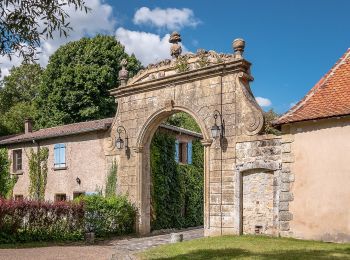
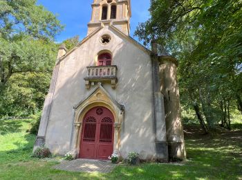
• Départ du parking Saint-Michel ou de l'abbaye de Villers-Bettnach. Un circuit en pleine nature, où la légende dit que...

Randonnée Marche Saint-Hubert - Randonnée du Haut Chemin - Le chêne des Moines - Villers Bettnach - Photo
Marche 6.772
Km

Marche

Moyen
Saint-Hubert, Grand Est, Moselle, France
6,8 km | 8,7 km-effort
1h 30min
143 m
139 m
Oui
tracegps

• Une promenade familiale idéale pour l'initiation à la randonnée ou au VTT dans la profonde forêt de Villers sur les t...

Randonnée Marche Saint-Hubert - rando psa - Photo
Marche 11.679
Km

Marche

Facile
Saint-Hubert, Grand Est, Moselle, France
11,7 km | 15,4 km-effort
3h 19min
278 m
280 m
Oui
cyclopat

• rando psa

Randonnée Marche Saint-Hubert - rando psa - Photo
Marche 11.679
Km

Marche

Facile
(1)
Saint-Hubert, Grand Est, Moselle, France
11,7 km | 15,4 km-effort
3h 19min
278 m
280 m
Oui
cyclopat

• rando psa

Randonnée Marche Saint-Hubert - Saint-Hubert 5 mai 2013 - Photo
Marche 17.178
Km

Marche

Très facile
Saint-Hubert, Grand Est, Moselle, France
17,2 km | 22 km-effort
3h 31min
344 m
334 m
Oui
lbu

Randonnée Marche Saint-Hubert - 2023 05 29 Rabat HS 8 km - Photo
Marche 8.051
Km

Marche

Moyen
Saint-Hubert, Grand Est, Moselle, France
8,1 km | 10,1 km-effort
2h 31min
153 m
159 m
Oui
bstebe

Randonnée Marche Saint-Hubert - 2022 08 16 Rabas HS - Photo
Marche 8.29
Km

Marche

Moyen
Saint-Hubert, Grand Est, Moselle, France
8,3 km | 10,4 km-effort
2h 34min
159 m
165 m
Oui
bstebe

Randonnée Marche Saint-Hubert - 2020 07 14 Villers Bethnach BF - Photo
Marche 8.355
Km

Marche

Très facile
Saint-Hubert, Grand Est, Moselle, France
8,4 km | 10,6 km-effort
2h 23min
170 m
167 m
Oui
bstebe

Randonnée Marche Saint-Hubert - balade de l'étang aux moines. - Photo
Marche 6.76
Km

Marche

Très facile
Saint-Hubert, Grand Est, Moselle, France
6,8 km | 8,7 km-effort
1h 54min
152 m
129 m
Non
breton111

Randonnée Marche Saint-Hubert - MJW 3-6 - Photo
Marche 21.665
Km

Marche

Facile
Saint-Hubert, Grand Est, Moselle, France
22 km | 25 km-effort
5h 28min
262 m
296 m
Non
hubbi

13 randonnées affichées sur 13

Application GPS de randonnée GRATUITE

Logo SityTrail SityTrail

IGN / Instituts géographiques

Télécharger SityTrail sur l'App Store Télécharger SityTrail sur Google Play

Logo SityTrail SityTrail World

Le monde est à vous

Télécharger SityTrail sur l'App Store Télécharger SityTrail sur Google Play Télécharger SityTrail sur Huawei AppGallery

Activités

Fermer
Mes abonnements