


15,5 km | 19,8 km-effort
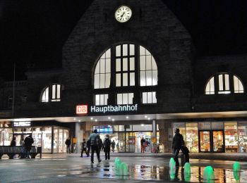
Aix-la-Chapelle : découvrez les meilleures randonnées : 87 pédestres et 21 à vélo ou VTT. Tous ces circuits, parcours, itinéraires et activités en plein air sont disponibles dans nos applications SityTrail pour smartphones et tablettes.
Marche


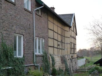
• Parcours retracé sur base des sentiers locaux. 💚 Une rando coup de cœur ! ➡️ Juste au sud d'Aix-la-Chapelle se trouv...
Marche
• ℹ www.aachen.de/wandern 📌🅿️ Lütticher Strabe 340 ➡️ Points-noeuds 16 14 65 64 63 62 61 60 51 48 45 44 55 15 16.
Marche
• ℹ www.aachen.de/wandern 📌 🅿️ Köpfchen, Eupener Strabe. ➡️ Points-noeuds 59 58 70 71 72 75 78 79 80 81 35 38 26 70 ...
Marche
• 📍 & 🅿️ Lütticher Strabe 340 ➡️ Points-noeuds 16 17 67 68 46 77 25 26 10 9 ... vers le centre et retour ... 4 5 6 ...
A pied
• Arbeitsgruppe Wanderwege: Die unmittelbare Umgebung des Ortsteils für Wanderer zu erschließen, auszugestalten und mit...
A pied
• vor Ort nicht als "6" gekennzeichnet, wurde wohl lediglich pro forma in das Routennetz aufgenommen Symbole: schwarze...
A pied
• Symbole: blauer Pfeil aufwärts
A pied
• Randonnée créée par Stadt Aachen, Fachbereich Umwelt und Fachbereich Stadtentwicklung und Verkehrsanlagen. weiter na...
A pied
• Randonnée créée par Stadt Aachen, Fachbereich Umwelt und Fachbereich Stadtentwicklung und Verkehrsanlagen.
A pied
• Randonnée créée par Stadt Aachen, Fachbereich Umwelt und Fachbereich Stadtentwicklung und Verkehrsanlagen.
A pied
• Symbole: weisses Rechteck mit runder blau/grüner Flusslandschaft
A pied
• Randonnée créée par Stadt Aachen, Fachbereich Stadtentwicklung und Verkehrsanlagen; Stadt Herzogenrath, Fachbereich S...
A pied
• Randonnée créée par Stadt Aachen, Fachbereich Umwelt und Fachbereich Stadtentwicklung und Verkehrsanlagen. Site we...
A pied
• Randonnée créée par Stadt Aachen, Fachbereich Umwelt und Fachbereich Stadtentwicklung und Verkehrsanlagen. Site we...
A pied
• Randonnée créée par Stadt Aachen, Fachbereich Umwelt und Fachbereich Stadtentwicklung und Verkehrsanlagen. Site we...
Marche
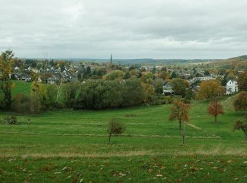
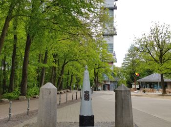
• Superbe boucle en direction de La Calamine. 📌 & 🅿️ au sommet de la route des Trois Bornes à Gemmenich. ℹ www.wande...
Marche
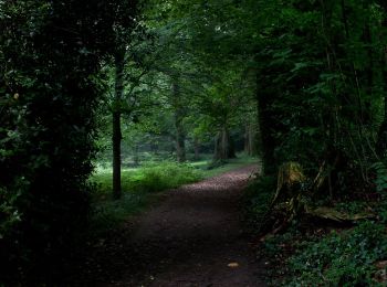
![Randonnée A pied Aix-la-Chapelle - [5] Itertalweg - Variante als Rundweg - Photo](https://media.geolcdn.com/t/350/260/ext.jpg?maxdim=2&url=https%3A%2F%2Fmedia.geolcdn.com%2Ff%2F484480c9-a885-4696-8e01-a48866a6fd77.jpeg)
A pied
A pied
A pied
20 randonnées affichées sur 113
Application GPS de randonnée GRATUITE
 SityTrail
IGN / Instituts géographiques
SityTrail World
Le monde est à vous